MyTopo
Wall Lake New Mexico US Topo Map
Couldn't load pickup availability
Also explore the Wall Lake Forest Service Topo of this same quad for updated USFS data
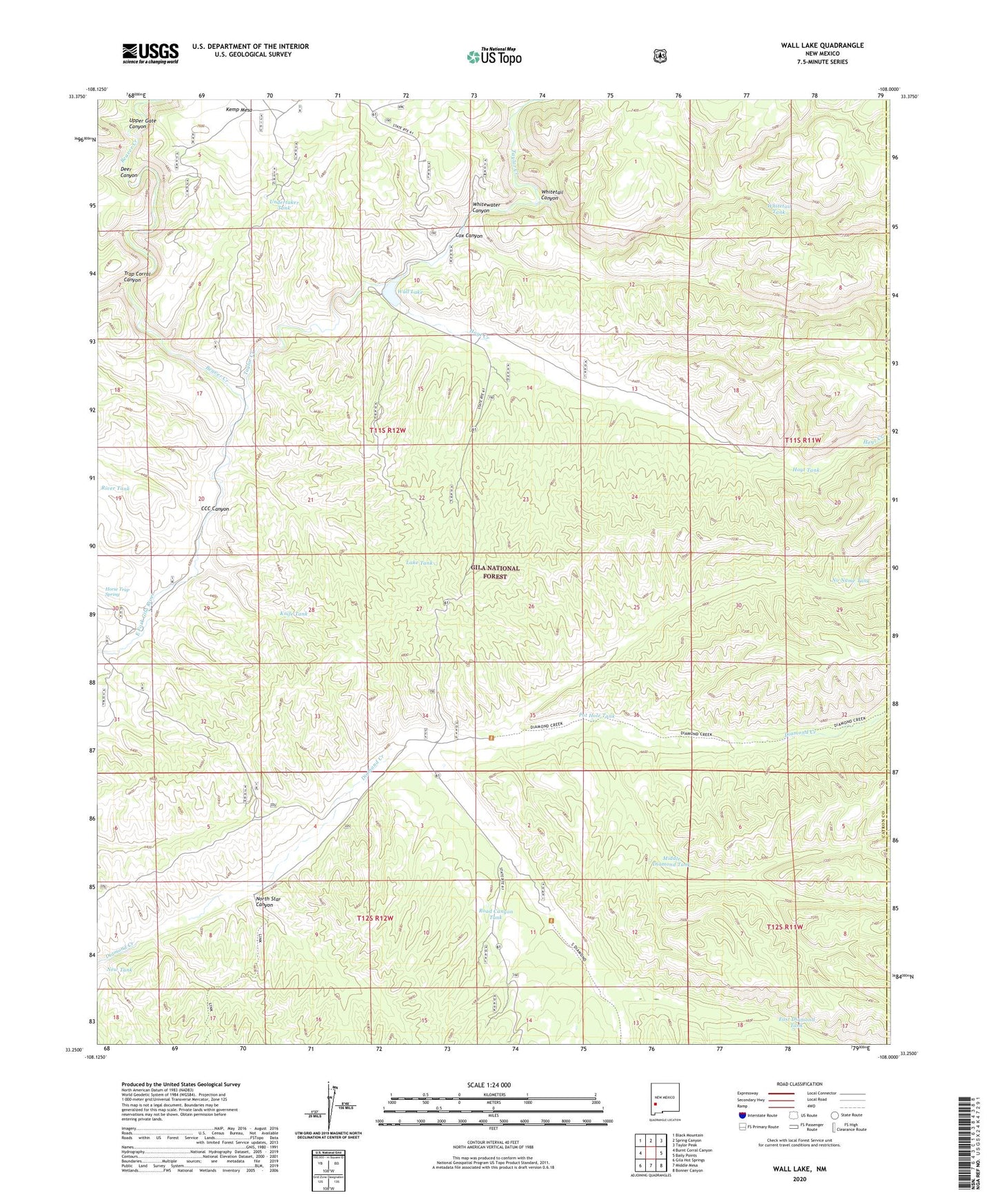
2023 topographic map quadrangle Wall Lake in the state of New Mexico. Scale: 1:24000. Based on the newly updated USGS 7.5' US Topo map series, this map is in the following counties: Catron, Sierra. The map contains contour data, water features, and other items you are used to seeing on USGS maps, but also has updated roads and other features. This is the next generation of topographic maps. Printed on high-quality waterproof paper with UV fade-resistant inks.
Quads adjacent to this one:
West: Burnt Corral Canyon
Northwest: Black Mountain
North: Spring Canyon
Northeast: Taylor Peak
East: Baily Points
Southeast: Bonner Canyon
South: Middle Mesa
Southwest: Gila Hot Springs
This map covers the same area as the classic USGS quad with code o33108c1.
Contains the following named places: Beaver Creek, CCC Canyon, Cobb Well, Cox Canyon, D Bar Ranch, Deer Canyon, Dry Diamond Creek, East Diamond Creek, East Diamond Tank, Horse Trap Spring, Hoyt Creek, Hoyt Tank, Knife Tank, Lake Tank, Links Ranch, Lost Tank, Middle Diamond Creek, Middle Diamond Tank, Middle Diamond Tank Number Two, Middle Diamond Well, New Tank, No Name Tank, North Star Canyon, Pot Hole Tank, River Tank, Road Canyon Tank, South Diamond Creek, South Diamond Well, Steeple U Ranch, Taylor Creek, Taylor Creek Placer and Lode, Trap Corral Canyon, Undertaker Tank, Upper Gate Canyon, Wall Lake, Wall Lake Campground, Whitetail Canyon, Whitetail Tank, Whitewater Canyon