MyTopo
The Saltys New Mexico US Topo Map
Couldn't load pickup availability
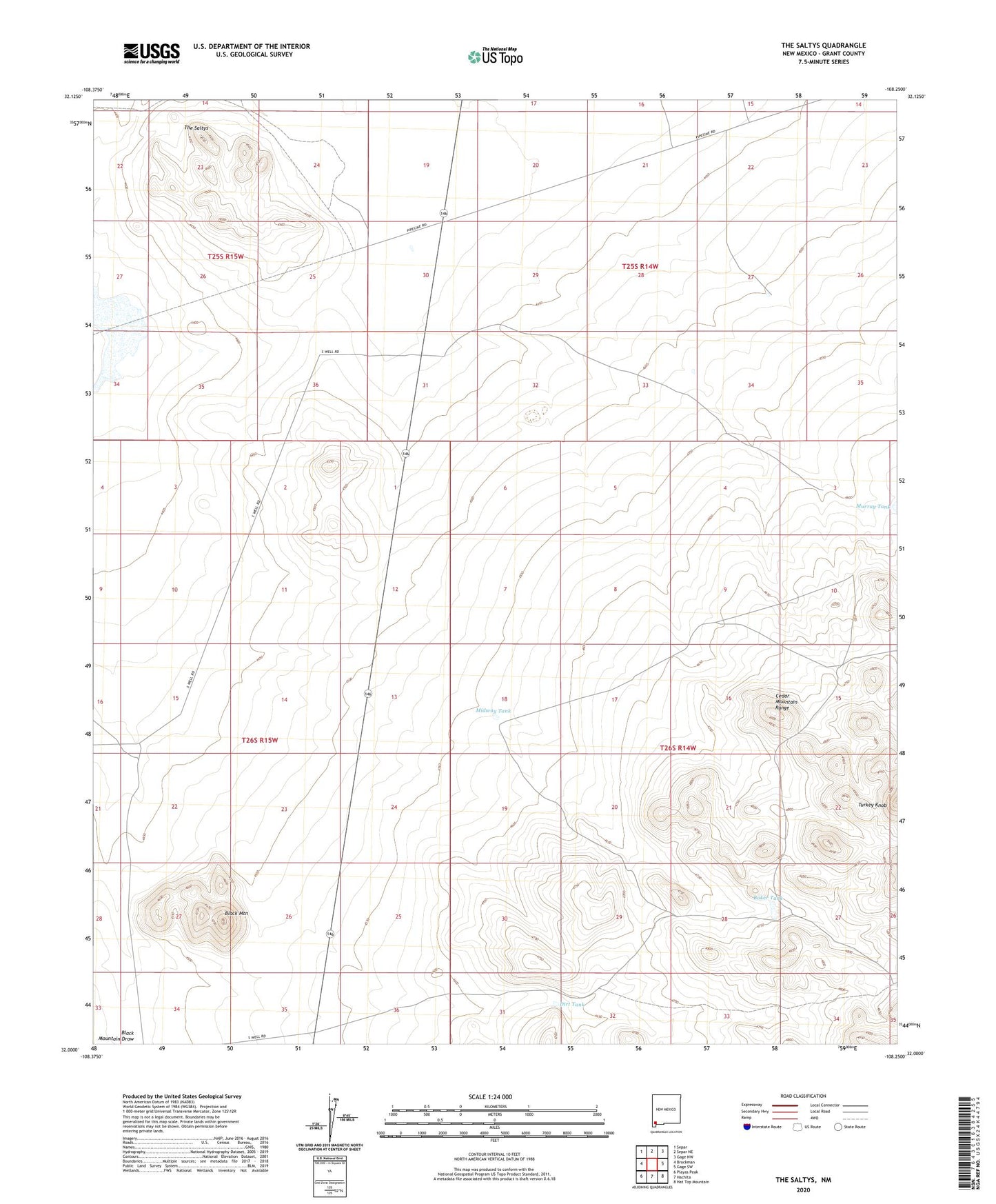
2020 topographic map quadrangle The Saltys in the state of New Mexico. Scale: 1:24000. Based on the newly updated USGS 7.5' US Topo map series, this map is in the following counties: Grant. The map contains contour data, water features, and other items you are used to seeing on USGS maps, but also has updated roads and other features. This is the next generation of topographic maps. Printed on high-quality waterproof paper with UV fade-resistant inks.
Quads adjacent to this one:
West: Brockman
Northwest: Separ
North: Separ NE
Northeast: Gage NW
East: Gage SW
Southeast: Hat Top Mountain
South: Hachita
Southwest: Playas Peak
Contains the following named places: Baker Tank, Baker Tank Water Well, Black Mountain, Black Mountain Water Well, Black Mountain Well, Dirt Tank, Little Windmill, Midway Tank, Murray Water Wells, Murray Wells, The Saltys, Turkey Knob