
MyTopo
Hat Top Mountain New Mexico US Topo Map
Couldn't load pickup availability
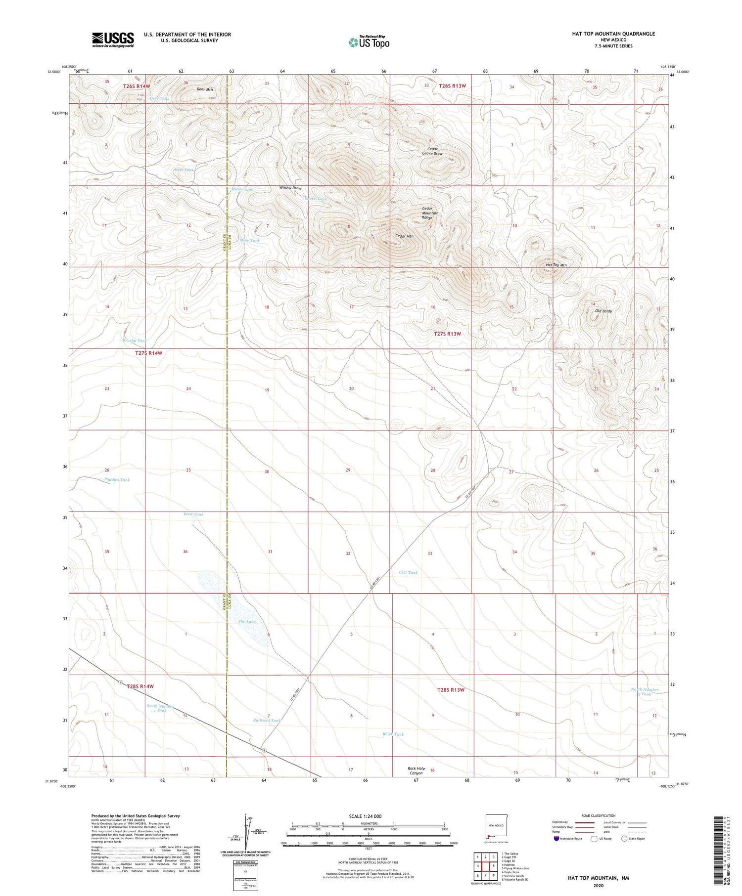
2023 topographic map quadrangle Hat Top Mountain in the state of New Mexico. Scale: 1:24000. Based on the newly updated USGS 7.5' US Topo map series, this map is in the following counties: Luna, Grant. The map contains contour data, water features, and other items you are used to seeing on USGS maps, but also has updated roads and other features. This is the next generation of topographic maps. Printed on high-quality waterproof paper with UV fade-resistant inks.
Quads adjacent to this one:
West: Hachita
Northwest: The Saltys
North: Gage SW
Northeast: Gage SE
East: Flying W Mountain
Southeast: Victorio Ranch SE
South: Victorio Ranch
Southwest: Doyle Peak
This map covers the same area as the classic USGS quad with code o31108h2.
Contains the following named places: 01640 Water Well, Black Tank, Brushy Tank, CCC Tank, Cedar Mountain, Cedar Mountains Wilderness Study Area, Deep Wells, Deer Mountain, Deer Tank, East Tank, Eaulkner Ranch, Hat Top Mountain, Little Windmill, Lucky Mine, Mine Tank, Mittle Tank, Mountain Well, North Number 3 Tank, Old Baldy, Puddles Tank, Railroad Tank, Snake Tank, South Number 1 Tank, The Lake, West Tank


