MyTopo
Thimble Canyon New Mexico US Topo Map
Couldn't load pickup availability
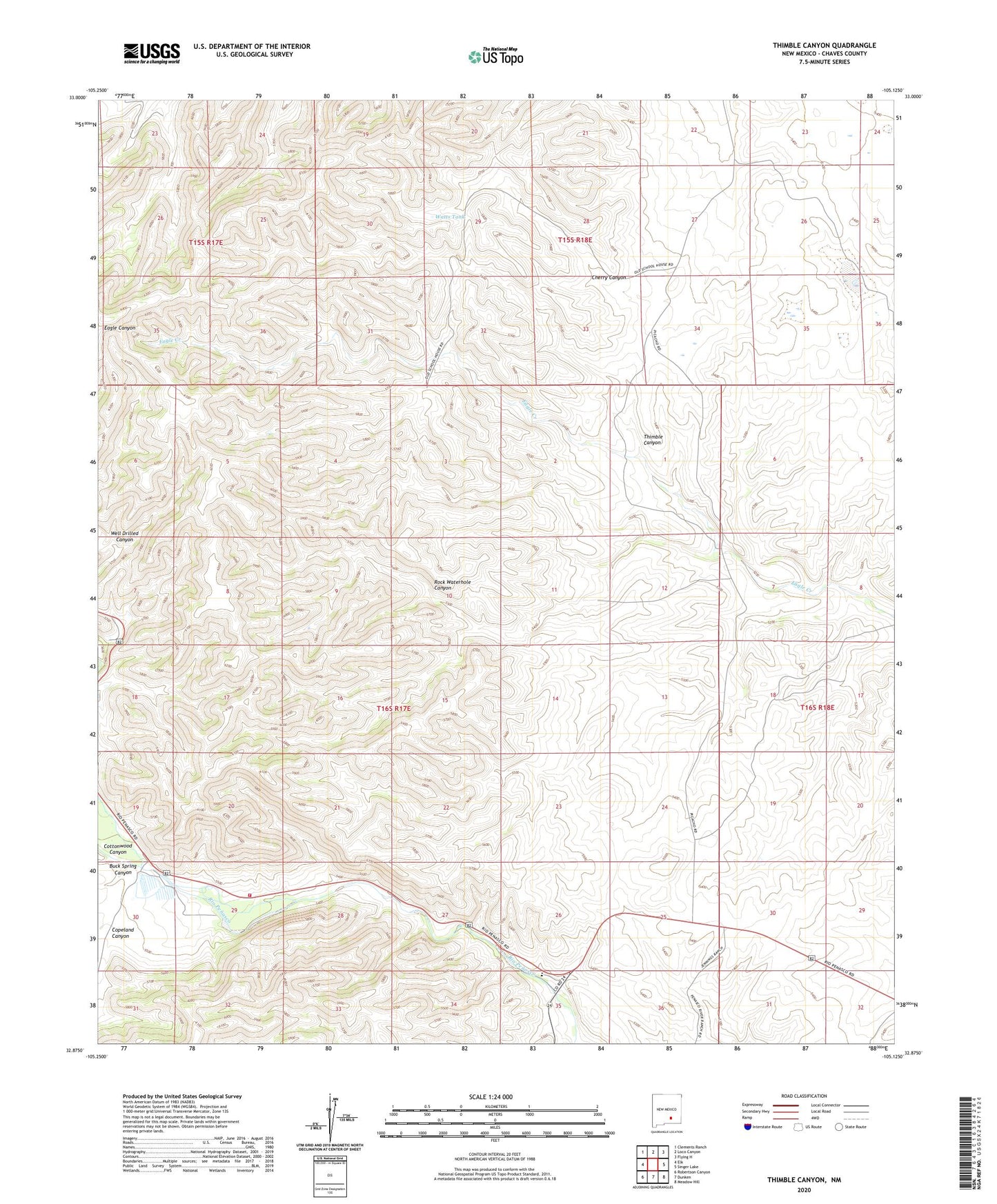
2020 topographic map quadrangle Thimble Canyon in the state of New Mexico. Scale: 1:24000. Based on the newly updated USGS 7.5' US Topo map series, this map is in the following counties: Chaves. The map contains contour data, water features, and other items you are used to seeing on USGS maps, but also has updated roads and other features. This is the next generation of topographic maps. Printed on high-quality waterproof paper with UV fade-resistant inks.
Quads adjacent to this one:
West: Elk
Northwest: Clements Ranch
North: Loco Canyon
Northeast: Flying H
East: Singer Lake
Southeast: Meadow Hill
South: Dunken
Southwest: Robertson Canyon
Contains the following named places: 10634 Water Well, 10646 Water Well, 10648 Water Well, 88339, Buck Spring Canyon, Cherry Canyon, Copeland Canyon, Cottonwood Canyon, Dirt Tank Well, Eagle Well, Lake Windmill, Old Longbotham Place, Penasco School, Penasco Volunteer Fire Department Main Station, Reeyes Ranch, Rock Waterhole Canyon, Runyan Ranch, Taylor Ranch, Teal Canyon, Thimble Canyon, Watts Tank, Well Drilled Canyon