MyTopo
Dunken New Mexico US Topo Map
Couldn't load pickup availability
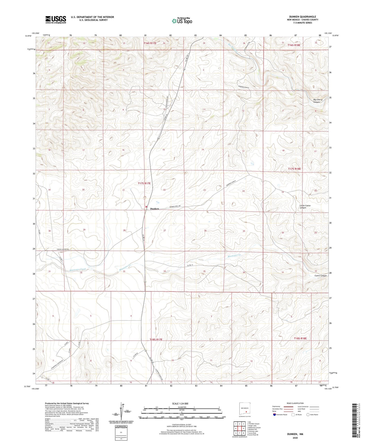
2023 topographic map quadrangle Dunken in the state of New Mexico. Scale: 1:24000. Based on the newly updated USGS 7.5' US Topo map series, this map is in the following counties: Chaves. The map contains contour data, water features, and other items you are used to seeing on USGS maps, but also has updated roads and other features. This is the next generation of topographic maps. Printed on high-quality waterproof paper with UV fade-resistant inks.
Quads adjacent to this one:
West: Robertson Canyon
Northwest: Elk
North: Thimble Canyon
Northeast: Singer Lake
East: Meadow Hill
Southeast: Lewis Peak NE
South: Lewis Peak
Southwest: Chimney Lake
This map covers the same area as the classic USGS quad with code o32105g2.
Contains the following named places: Almo Well, Big Cherry Canyon, Cuevo Ranch, Davenport Ranch, Dunken, Dunken Cemetery, Dunken Post Office, Dunken Volunteer Fire Department, Dunken Windmill, Harwell Ranch, Penasco River Ranch, Treat Windmill, Viejo Well