MyTopo
Tinian New Mexico US Topo Map
Couldn't load pickup availability
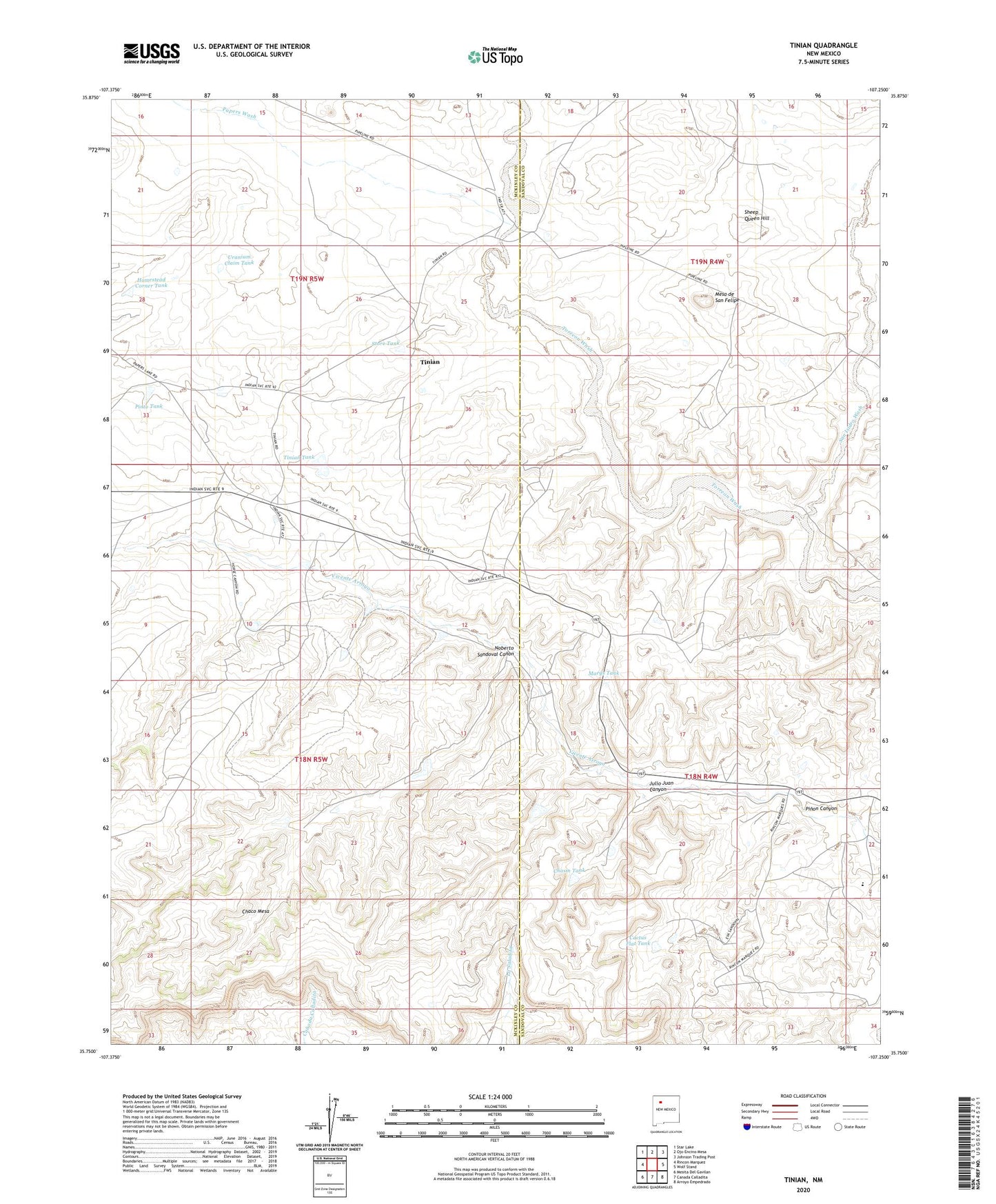
2020 topographic map quadrangle Tinian in the state of New Mexico. Scale: 1:24000. Based on the newly updated USGS 7.5' US Topo map series, this map is in the following counties: McKinley, Sandoval. The map contains contour data, water features, and other items you are used to seeing on USGS maps, but also has updated roads and other features. This is the next generation of topographic maps. Printed on high-quality waterproof paper with UV fade-resistant inks.
Quads adjacent to this one:
West: Rincon Marquez
Northwest: Star Lake
North: Ojo Encino Mesa
Northeast: Johnson Trading Post
East: Wolf Stand
Southeast: Arroyo Empedrado
South: Canada Calladita
Southwest: Mesita Del Gavilan
Contains the following named places: 15R-312 Water Well, 15R-315 Water Well, 19K-333 Water Well, Cactus Flat Tank, Chasm Dam, Chasm Tank, Homestead Corner Tank, Julio Juan Canyon, Marys Tank, Mesa de San Felipe, Noberto Sandoval Canon, Papers Wash, Pinon Canyon, Pinon Canyon Dam Number Four, Pinon Canyon Dam Number One, Pinto Tank, R-51 Water Well, San Isidro Wash, Sheep Queen Hill, Store Tank, Tinian, Tinian Mission, Tinian Tank, Tinian Trading Post, Torreon Chapter, Torreon Trading Post, Uranium Claim Tank