MyTopo
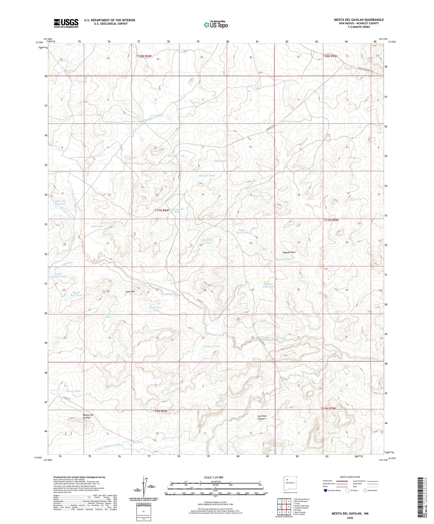
Mesita Del Gavilan New Mexico US Topo Map
Couldn't load pickup availability
2023 topographic map quadrangle Mesita Del Gavilan in the state of New Mexico. Scale: 1:24000. Based on the newly updated USGS 7.5' US Topo map series, this map is in the following counties: McKinley. The map contains contour data, water features, and other items you are used to seeing on USGS maps, but also has updated roads and other features. This is the next generation of topographic maps. Printed on high-quality waterproof paper with UV fade-resistant inks.
Quads adjacent to this one:
West: Mesita Americana
Northwest: Whitehorse Rincon
North: Rincon Marquez
Northeast: Tinian
East: Canada Calladita
Southeast: Cerro Parido
South: Mesa Cortada
Southwest: El Dado
This map covers the same area as the classic USGS quad with code o35107f4.
Contains the following named places: 15T-543 Water Well, Alcario Tank, Amos Pit Reservoir, Arroyo Calladito, Arroyo Lucero, Bench Rock Tank, Big Cedar Tank, Borderline Tank, Castle Rock Tank, Cone Hill, Cone Hill Tank, Cottonwood Tank, Echo Tank, Fishback Tank, Indian Pond, Martinez Tank, Mauled Cedar Tank, Mesita del Gavilan, North Fork Arroyo Chico, Pagoda Rock, Pagoda Tank, Rancho Rincon Marquez, Rincon Marquez Arroyo, Steamboat Tank, Stockade Tank, Vega Tank