MyTopo
Johnson Trading Post New Mexico US Topo Map
Couldn't load pickup availability
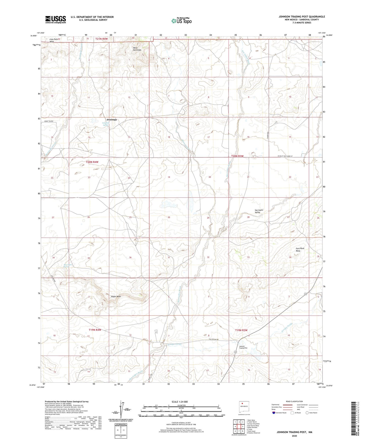
2023 topographic map quadrangle Johnson Trading Post in the state of New Mexico. Scale: 1:24000. Based on the newly updated USGS 7.5' US Topo map series, this map is in the following counties: Sandoval. The map contains contour data, water features, and other items you are used to seeing on USGS maps, but also has updated roads and other features. This is the next generation of topographic maps. Printed on high-quality waterproof paper with UV fade-resistant inks.
Quads adjacent to this one:
West: Ojo Encino Mesa
Northwest: Deer Mesa
North: Taylor Ranch
Northeast: Arroyo Chijuillita
East: Mesa Portales
Southeast: Headcut Reservoir
South: Wolf Stand
Southwest: Tinian
This map covers the same area as the classic USGS quad with code o35107h2.
Contains the following named places: 19T-514 Water Well, 19T-515 Water Well, 19T-516 Water Well, Alto Well, Arroyo Jarido, Eagle Mesa, Encino Detention Dam Number 40, Encino Detention Dam Number 98, Encino Detention Dam Number Two, Horn Arroyo, Johnson Trading Post, Johnson Well, Max Lopez Spring, Penistaja, Penistaja Post Office, Penistaja Spring, Penistaja Well, San Isidro Valley, Wp Johnson Erosion Control Dam