MyTopo
Arroyo Empedrado New Mexico US Topo Map
Couldn't load pickup availability
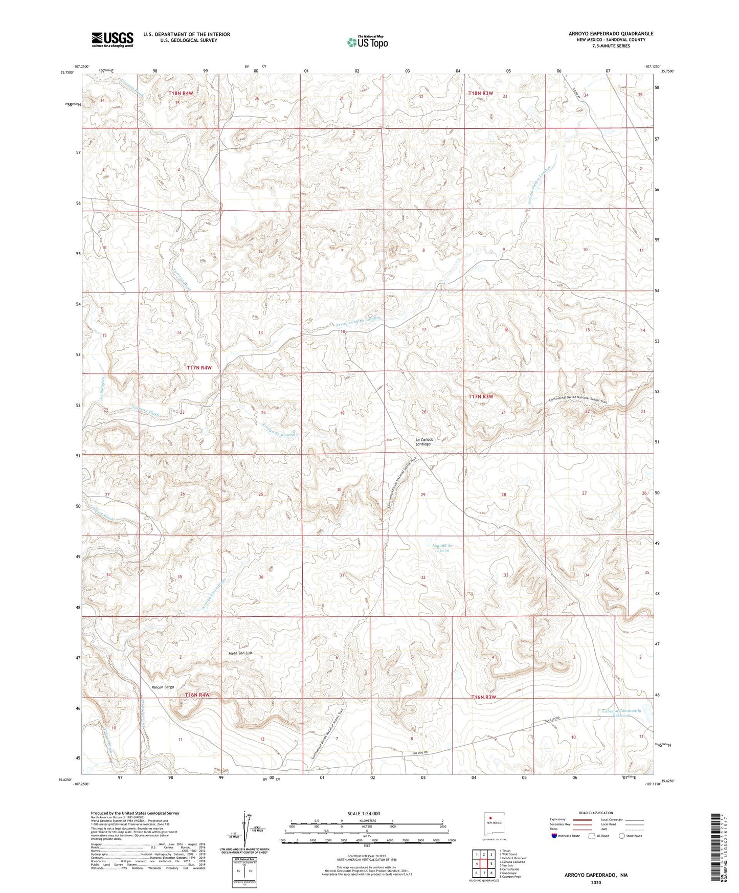
2023 topographic map quadrangle Arroyo Empedrado in the state of New Mexico. Scale: 1:24000. Based on the newly updated USGS 7.5' US Topo map series, this map is in the following counties: Sandoval. The map contains contour data, water features, and other items you are used to seeing on USGS maps, but also has updated roads and other features. This is the next generation of topographic maps. Printed on high-quality waterproof paper with UV fade-resistant inks.
Quads adjacent to this one:
West: Canada Calladita
Northwest: Tinian
North: Wolf Stand
Northeast: Headcut Reservoir
East: San Luis
Southeast: Cabezon Peak
South: Guadalupe
Southwest: Cerro Parido
This map covers the same area as the classic USGS quad with code o35107f2.
Contains the following named places: Arroyo de Rosendo, Arroyo Empedrado, Arroyo Piedra Lumbre, Cabezon Community Reservoir, Empedrado Wilderness Study Area, La Lena Wilderness Study Area, La Saladita, Laguna de la Lena, R-33 Water Well, R-43 Water Well, Rincon Largo, Torreon Wash