MyTopo
Canada Calladita New Mexico US Topo Map
Couldn't load pickup availability
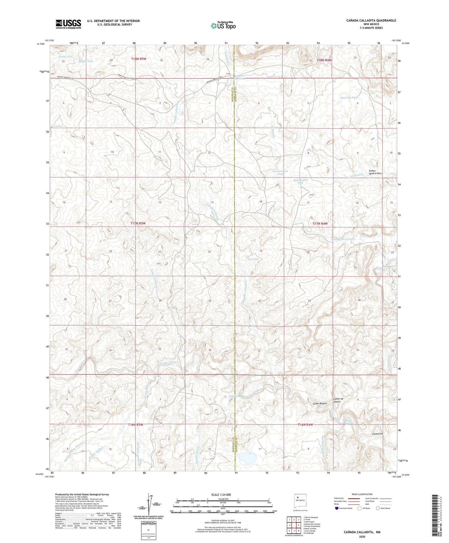
2023 topographic map quadrangle Canada Calladita in the state of New Mexico. Scale: 1:24000. Based on the newly updated USGS 7.5' US Topo map series, this map is in the following counties: McKinley, Sandoval. The map contains contour data, water features, and other items you are used to seeing on USGS maps, but also has updated roads and other features. This is the next generation of topographic maps. Printed on high-quality waterproof paper with UV fade-resistant inks.
Quads adjacent to this one:
West: Mesita Del Gavilan
Northwest: Rincon Marquez
North: Tinian
Northeast: Wolf Stand
East: Arroyo Empedrado
Southeast: Guadalupe
South: Cerro Parido
Southwest: Mesa Cortada
This map covers the same area as the classic USGS quad with code o35107f3.
Contains the following named places: 10009 Water Well, 15B-32 Water Well, Arroyo Gallina, Arroyo la Azabache, Arroyo Seccion, B P Hovey Ranch Prospect, Canada Alimento, Canada Bernardino, Canada Calladita, Canada Lagunita, Canada Salada, Canon Blanco, Canon de Alamo, Canon Ignacio Rico, Canoncito, Cholla Tank, Cholla Water Well, County Line Dam, County Line Pit, County Line Tank, E Montoya Dam Number Nine, Lost Tank, Mud Flat Tank, R-23 Water Well, R-24 Water Well, Rancho De Stephan, Rattlesnake Tank, Saddle Tank, Sand Column Tank, Tucker Ranch