MyTopo
Trinchera Creek New Mexico US Topo Map
Couldn't load pickup availability
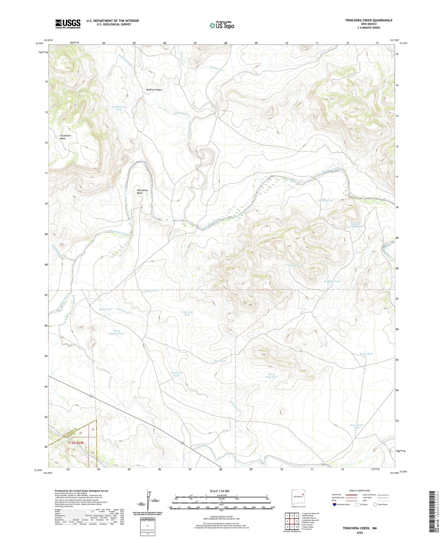
2020 topographic map quadrangle Trinchera Creek in the state of New Mexico. Scale: 1:24000. Based on the newly updated USGS 7.5' US Topo map series, this map is in the following counties: San Miguel, Quay. The map contains contour data, water features, and other items you are used to seeing on USGS maps, but also has updated roads and other features. This is the next generation of topographic maps. Printed on high-quality waterproof paper with UV fade-resistant inks.
Quads adjacent to this one:
West: Carpenter Mesa SW
Northwest: Carpenter Mesa NW
North: Medina Mesa
Northeast: Hampton Ranch
East: Bascom Camp
Southeast: Tucumcari
South: Liberty Mesa
Southwest: Cow Canyon
Contains the following named places: Antelope Tank, Artesian Windmill, Atarque Creek, Atarque Windmill, Bond, Canadian Windmill, Carpenter Creek, Carpenter Mesa, Carpenter Windmill, Chappell-Spade Ranch, Duck Tank, Frio Tank, Gartersnake Windmill, Government Tank, Horse Pasture Tank, Horseshoe Bend, Horseshoe Bend Windmill, Llano Pens, Llano Tank, Loma Cita Tank, Loma Tank, Medina Canyon, Mimosa Creek, Monitor Windmill, North Trap Tank, Rattlesnake Creek, Rattlesnake Tank, Rincon Tank, Road Creek, Rockpile Tanks, Sacaton Tank, Sink Hole Gap Reservoir Dam, Sink Hole Gap Stock Tank, Six Foot Windmill, Three P Trap Windmill, Trinchera Creek, Trinchera Tank, Trinchera Well