MyTopo
Trujillo New Mexico US Topo Map
Couldn't load pickup availability
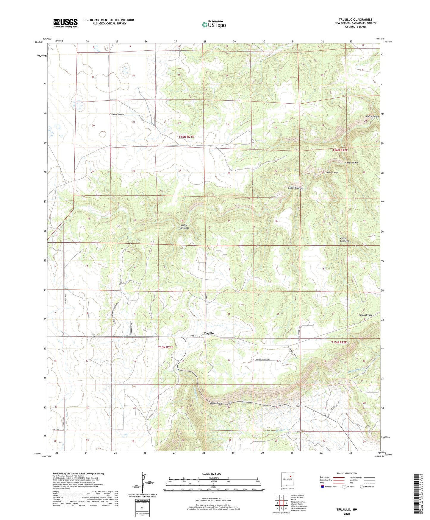
2023 topographic map quadrangle Trujillo in the state of New Mexico. Scale: 1:24000. Based on the newly updated USGS 7.5' US Topo map series, this map is in the following counties: San Miguel. The map contains contour data, water features, and other items you are used to seeing on USGS maps, but also has updated roads and other features. This is the next generation of topographic maps. Printed on high-quality waterproof paper with UV fade-resistant inks.
Quads adjacent to this one:
West: Laguna Huerfana
Northwest: Canon Pedroso
North: Llonidas Lake
Northeast: Maes
East: Canon Olguin
Southeast: Cerro De Corazon
South: Punta Del Chorro
Southwest: Flagstone Mountain
This map covers the same area as the classic USGS quad with code o37107a1.
Contains the following named places: Alta Vista, Canadian Escarpment Historical Marker, Canon Cuevas, Canon Escovas, Canon Isidro, Canon Santiago, Canon Ventanas, Corazon Hill, Elloy Estrado, Gutierrez, Pacheco, Trujillo