MyTopo
Llonidas Lake New Mexico US Topo Map
Couldn't load pickup availability
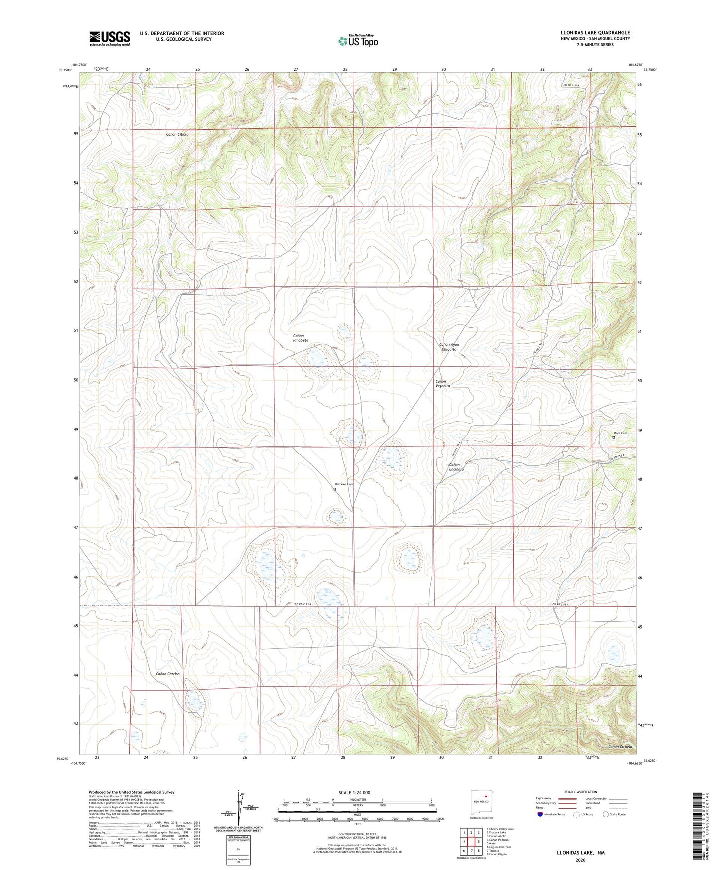
2023 topographic map quadrangle Llonidas Lake in the state of New Mexico. Scale: 1:24000. Based on the newly updated USGS 7.5' US Topo map series, this map is in the following counties: San Miguel. The map contains contour data, water features, and other items you are used to seeing on USGS maps, but also has updated roads and other features. This is the next generation of topographic maps. Printed on high-quality waterproof paper with UV fade-resistant inks.
Quads adjacent to this one:
West: Canon Pedroso
Northwest: Cherry Valley Lake
North: Frutosa Lake
Northeast: Canon Ancho
East: Maes
Southeast: Canon Olguin
South: Trujillo
Southwest: Laguna Huerfana
This map covers the same area as the classic USGS quad with code o35104f6.
Contains the following named places: Con-O-Kull 1 Stevenson, Crews, Griego, Llonidas Lake, Maes Cemetery, Mathews Cemetery, Southwest 1 Conchas, Wilson Ranch