
MyTopo
Twin Buttes New Mexico US Topo Map
Couldn't load pickup availability
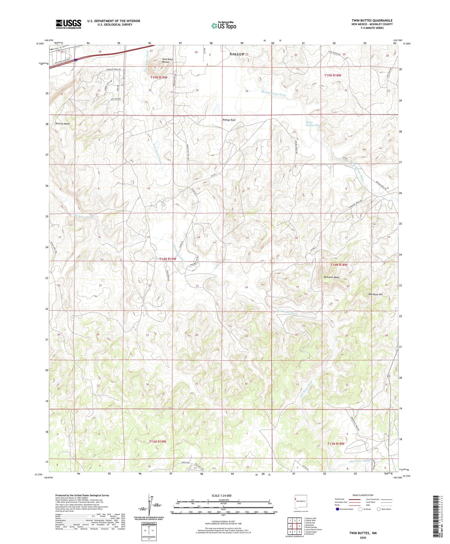
2020 topographic map quadrangle Twin Buttes in the state of New Mexico. Scale: 1:24000. Based on the newly updated USGS 7.5' US Topo map series, this map is in the following counties: McKinley. The map contains contour data, water features, and other items you are used to seeing on USGS maps, but also has updated roads and other features. This is the next generation of topographic maps. Printed on high-quality waterproof paper with UV fade-resistant inks.
Quads adjacent to this one:
West: Manuelito
Northwest: Samson Lake
North: Gallup West
Northeast: Gallup East
East: Bread Springs
Southeast: Pinehaven
South: Vanderwagen
Southwest: Jones Ranch School
Contains the following named places: Black Well, Crestview Census Designated Place, Gallup Titanium Deposit, Grenko Mine, Leyba Mine, Manning Mine, Mutual Col Water Well, Olson Pit, Red Rock, Red Rock Chapter, Red Rock Hill, Refuge Rock, Remnant Mesa, Rico Ranch, Thatcher Mine, Torrivio Mesa, Tree Well, Twin Buttes Pit, Twin Knoll Buttes, U.S. Mining-Olsen Mine, Williams Acres, Williams Acres Census Designated Place, ZIP Code: 87305


