MyTopo
Vanderwagen New Mexico US Topo Map
Couldn't load pickup availability
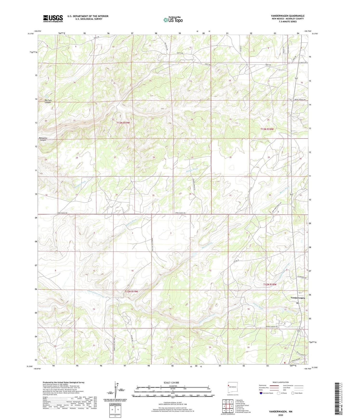
2023 topographic map quadrangle Vanderwagen in the state of New Mexico. Scale: 1:24000. Based on the newly updated USGS 7.5' US Topo map series, this map is in the following counties: McKinley. The map contains contour data, water features, and other items you are used to seeing on USGS maps, but also has updated roads and other features. This is the next generation of topographic maps. Printed on high-quality waterproof paper with UV fade-resistant inks.
Quads adjacent to this one:
West: Jones Ranch School
Northwest: Manuelito
North: Twin Buttes
Northeast: Bread Springs
East: Pinehaven
Southeast: Horsehead Canyon NW
South: Vanderwagen Draw
Southwest: Chi Chil Tah
This map covers the same area as the classic USGS quad with code o35108c7.
Contains the following named places: Big Falls, Chi Chil Tah Chapter, Dubois Wash, Hall, Kiwanis Park, Nelson Wash, Olson, Pine Tree Mission, Rico Ranch, Saint Patrick Catholic Church, Skeets Wash, Two Wells, Vanderwagen, Vanderwagen Post Office, Vanderwagen Volunteer Fire Department, Whitewater Census Designated Place, ZIP Code: 87326