MyTopo
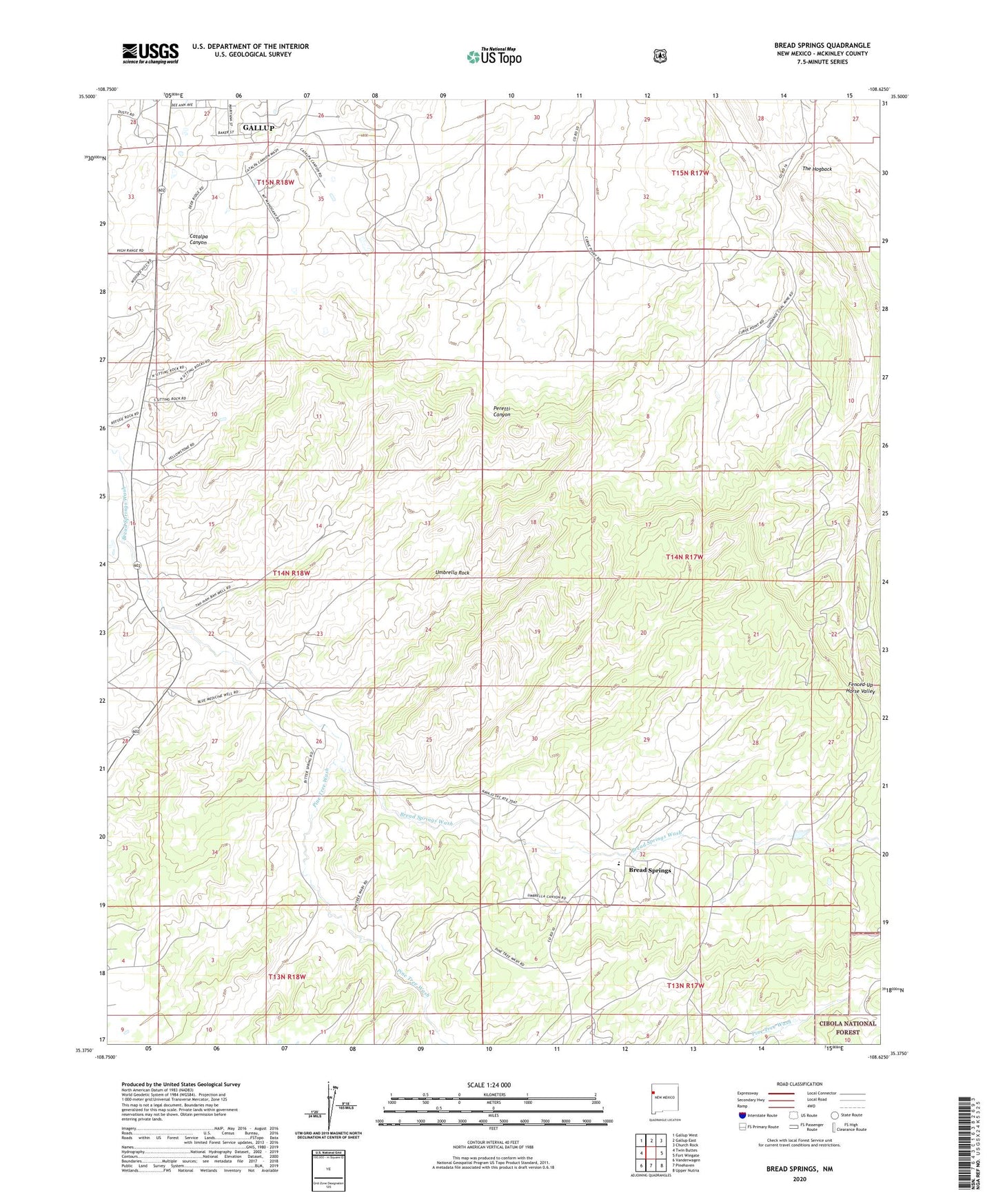
Bread Springs New Mexico US Topo Map
Couldn't load pickup availability
Also explore the Bread Springs Forest Service Topo of this same quad for updated USFS data
2023 topographic map quadrangle Bread Springs in the state of New Mexico. Scale: 1:24000. Based on the newly updated USGS 7.5' US Topo map series, this map is in the following counties: McKinley. The map contains contour data, water features, and other items you are used to seeing on USGS maps, but also has updated roads and other features. This is the next generation of topographic maps. Printed on high-quality waterproof paper with UV fade-resistant inks.
Quads adjacent to this one:
West: Twin Buttes
Northwest: Gallup West
North: Gallup East
Northeast: Church Rock
East: Fort Wingate
Southeast: Upper Nutria
South: Pinehaven
Southwest: Vanderwagen
This map covers the same area as the classic USGS quad with code o35108d6.
Contains the following named places: Ba-Ha-Li, Blue M Well, Bread Springs, Bread Springs Well, Browns Well, Catalpa Canyon Census Designated Place, Cresto Ranch, Franklin, Hyde Deposit, KQNM-FM (Gallup), Largo Number 4 Mine, Navajo Mission, Pine Tree Wash, Sundance, Sundance Mine, Tah Ha Bah Well, Umbrella Rock