MyTopo
Manuelito New Mexico US Topo Map
Couldn't load pickup availability
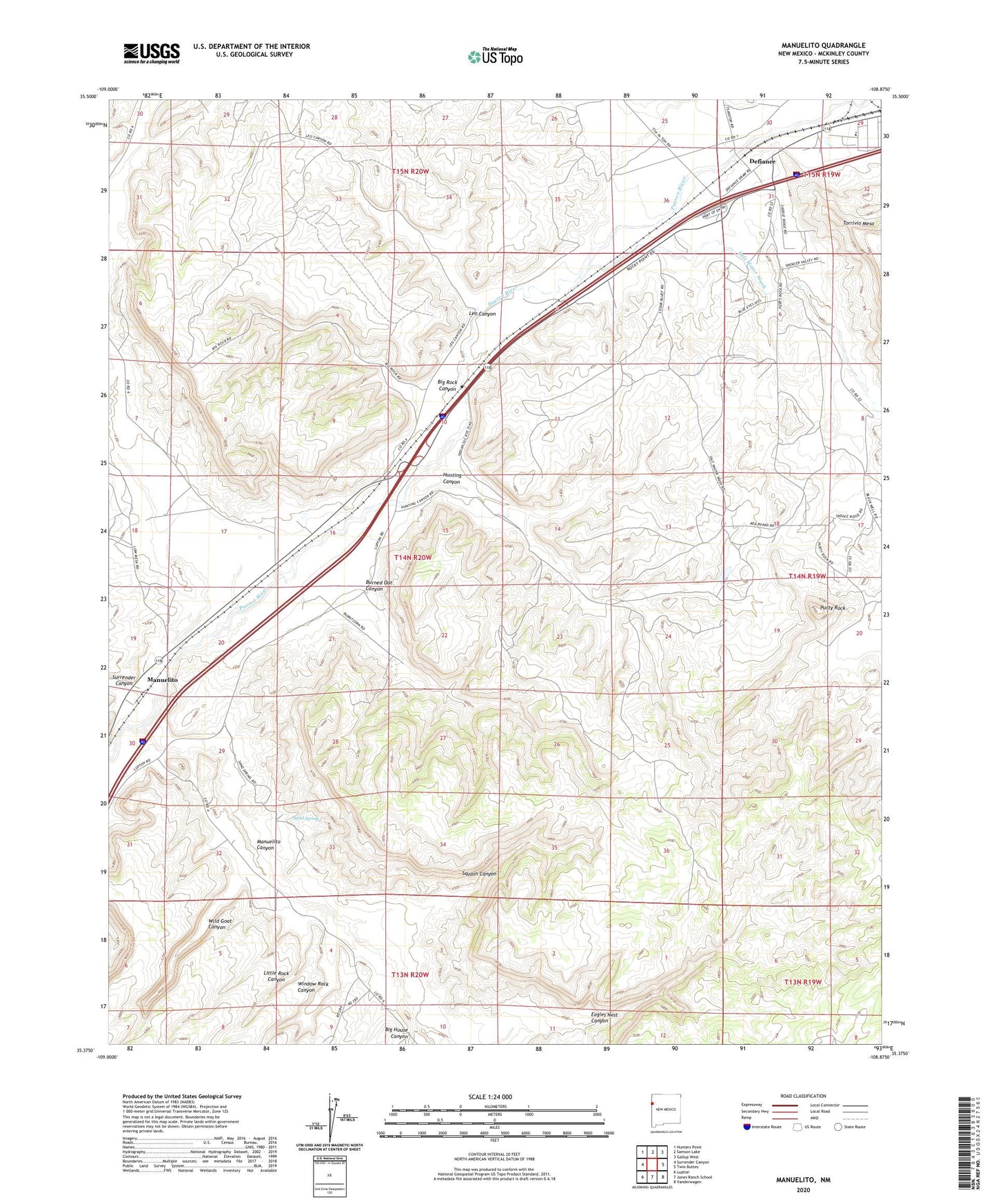
2023 topographic map quadrangle Manuelito in the state of New Mexico. Scale: 1:24000. Based on the newly updated USGS 7.5' US Topo map series, this map is in the following counties: McKinley. The map contains contour data, water features, and other items you are used to seeing on USGS maps, but also has updated roads and other features. This is the next generation of topographic maps. Printed on high-quality waterproof paper with UV fade-resistant inks.
Quads adjacent to this one:
West: Surrender Canyon
Northwest: Hunters Point
North: Samson Lake
Northeast: Gallup West
East: Twin Buttes
Southeast: Vanderwagen
South: Jones Ranch School
Southwest: Lupton
This map covers the same area as the classic USGS quad with code o35108d8.
Contains the following named places: Atsee Nitsaa Historic Site, Big House Canyon, Big House Historic Site, Big Rock Canyon, Burned Out Canyon, Defiance, Defiance Draw, Defiance Post Office, Eagles Nest Canyon, Hunting Canyon, Kin Hocho'i Historic Site, Leo Canyon, Little Rock Canyon, Manuelito, Manuelito Area Historical Marker, Manuelito Canyon, Manuelito Census Designated Place, Manuelito Post Office, Naat'a'anil Bikin, Purty Rock, Purty Rock Census Designated Place, Salt Water Wash, Sand Spring, Squash Canyon, Stepping Stone House Historic Site, Surrender Canyon, Vasquez de Coronados Route Historical Marker, Wild Goat Canyon, Williams Acres, Window Rock Canyon, Wolye A'din, ZIP Code: 87319