MyTopo
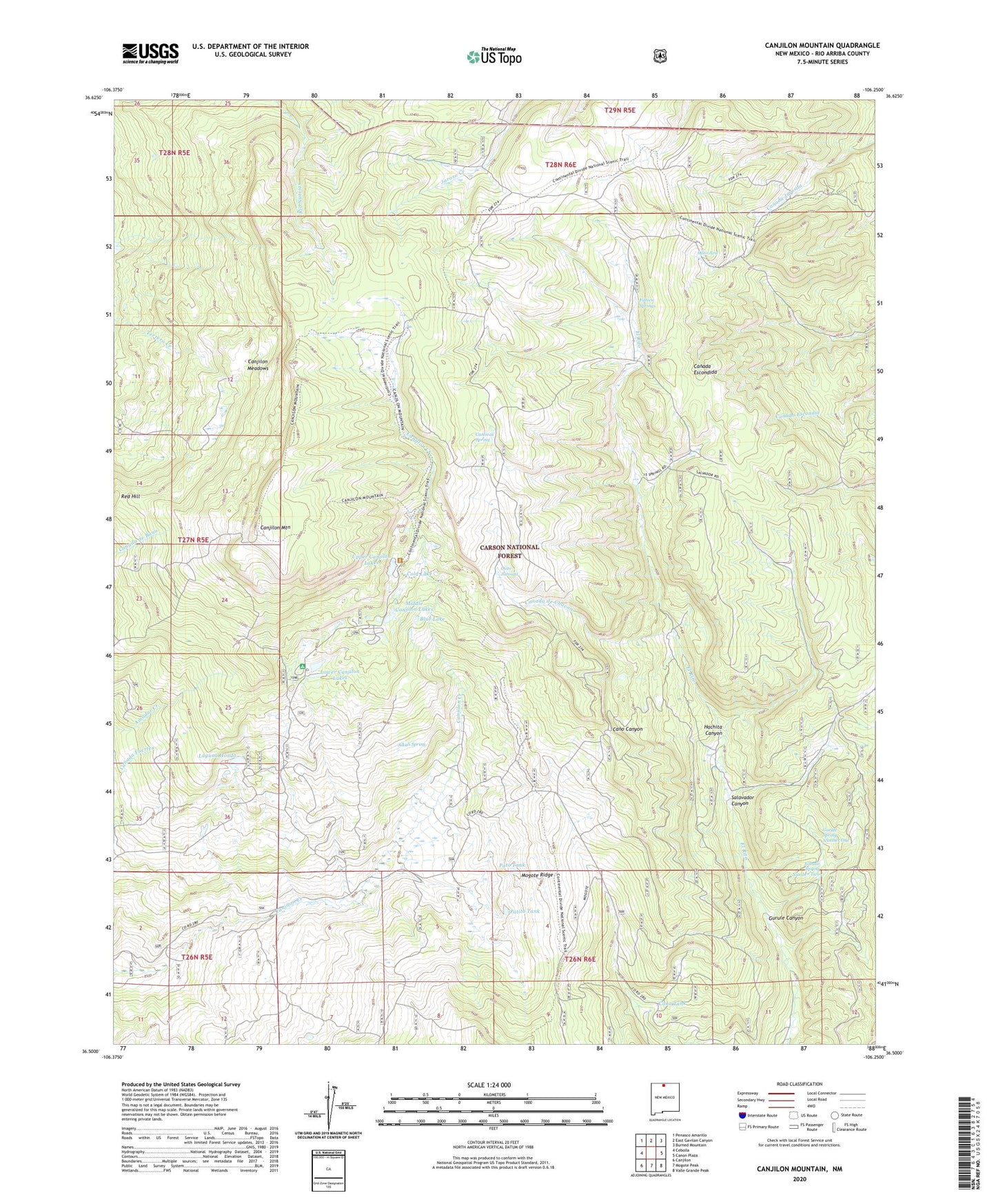
Canjilon Mountain New Mexico US Topo Map
Couldn't load pickup availability
Also explore the Canjilon Mountain Forest Service Topo of this same quad for updated USFS data
2023 topographic map quadrangle Canjilon Mountain in the state of New Mexico. Scale: 1:24000. Based on the newly updated USGS 7.5' US Topo map series, this map is in the following counties: Rio Arriba. The map contains contour data, water features, and other items you are used to seeing on USGS maps, but also has updated roads and other features. This is the next generation of topographic maps. Printed on high-quality waterproof paper with UV fade-resistant inks.
Quads adjacent to this one:
West: Cebolla
Northwest: Penasco Amarillo
North: East Gavilan Canyon
Northeast: Burned Mountain
East: Canon Plaza
Southeast: Valle Grande Peak
South: Mogote Peak
Southwest: Canjilon
This map covers the same area as the classic USGS quad with code o36106e3.
Contains the following named places: Alkali Spring, Blue Lake, Burns Lake, Canada de Chacon, Canjilon Creek Campground, Canjilon Creek Forest Camp, Canjilon Lakes, Canjilon Meadows, Canjilon Mountain, Cano Tank, Canovas Spring, Cold Lake, Fifteen Springs, Gurule Canyon, Gurule Spring Number One, Gurule Spring Number Two, Hachita Canyon, Laguna Honda, Lower Canjilon Lakes, Lower Canjilon Lakes Campground, Middle Canjilon Campground, Middle Canjilon Lakes, Ojito Azul, Ojito Jarosito, Patito Tank, Pato Tank, Salvador Canyon, Salvador Spring, Trujillo Tank, Upper Canjilon Lakes, Upper Canjilon Lakes Picnic Area