MyTopo
Vanderwagen Draw New Mexico US Topo Map
Couldn't load pickup availability
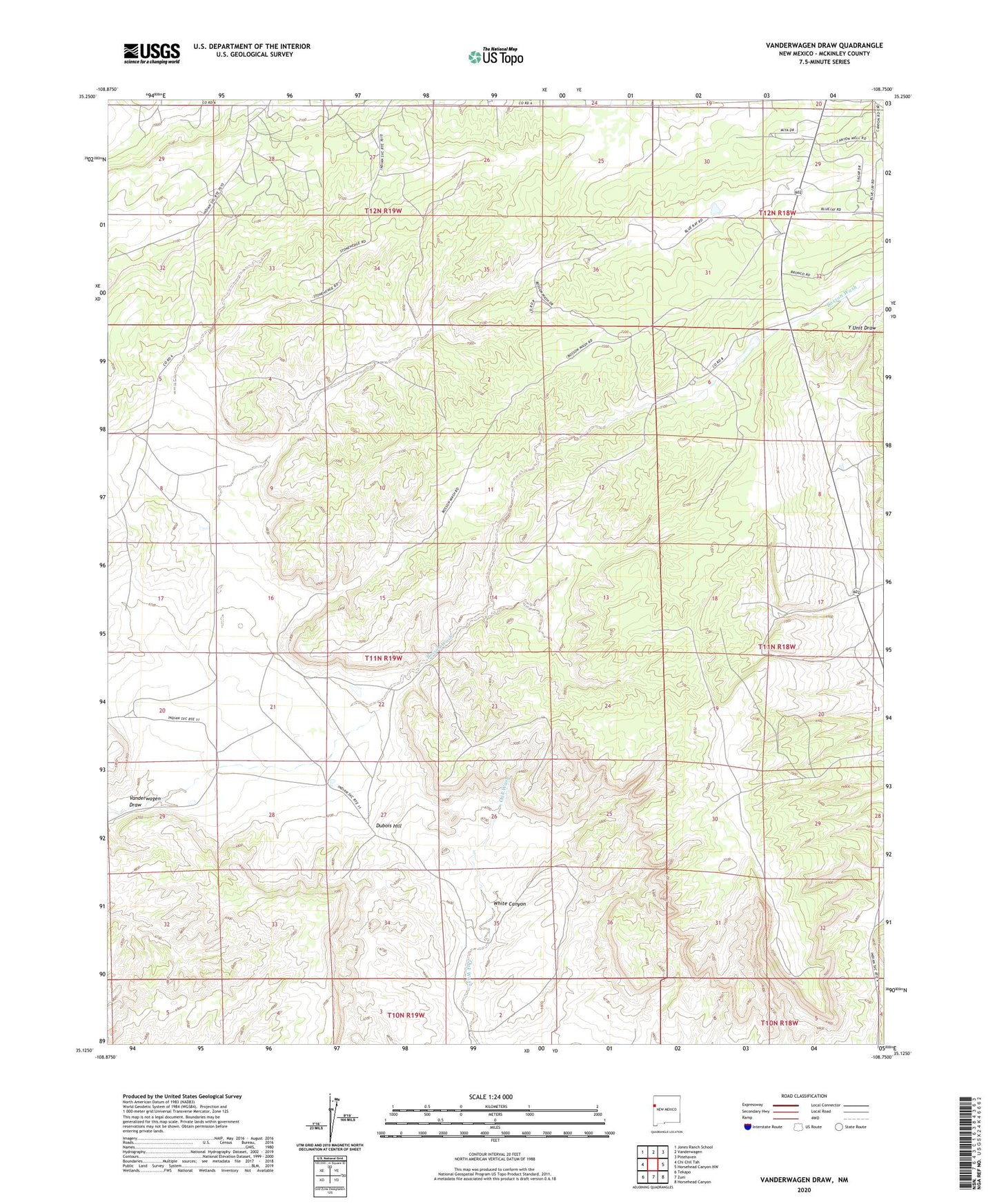
2023 topographic map quadrangle Vanderwagen Draw in the state of New Mexico. Scale: 1:24000. Based on the newly updated USGS 7.5' US Topo map series, this map is in the following counties: McKinley. The map contains contour data, water features, and other items you are used to seeing on USGS maps, but also has updated roads and other features. This is the next generation of topographic maps. Printed on high-quality waterproof paper with UV fade-resistant inks.
Quads adjacent to this one:
West: Chi Chil Tah
Northwest: Jones Ranch School
North: Vanderwagen
Northeast: Pinehaven
East: Horsehead Canyon NW
Southeast: Horsehead Canyon
South: Zuni
Southwest: Tekapo
This map covers the same area as the classic USGS quad with code o35108b7.
Contains the following named places: Chi Chil Tah Jones Ranch School, David Skeet Elementary, Dubois Hill, Gonzales Well, Sagar Census Designated Place, Vanderwagen Draw, White Canyon