MyTopo
Veteado Mountain New Mexico US Topo Map
Couldn't load pickup availability
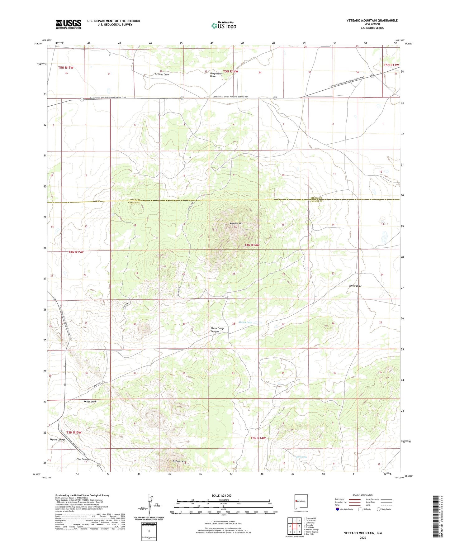
2023 topographic map quadrangle Veteado Mountain in the state of New Mexico. Scale: 1:24000. Based on the newly updated USGS 7.5' US Topo map series, this map is in the following counties: Catron, Cibola. The map contains contour data, water features, and other items you are used to seeing on USGS maps, but also has updated roads and other features. This is the next generation of topographic maps. Printed on high-quality waterproof paper with UV fade-resistant inks.
Quads adjacent to this one:
West: Techado
Northwest: Chimney Hill
North: Cerro Pomo
Northeast: La Rendija
East: Trail Lake
Southeast: Blue Hills
South: Adams Diggings
Southwest: Mariano Springs
This map covers the same area as the classic USGS quad with code o34108e3.
Contains the following named places: Black Ranch, Deep Water Draw, Dutch Lake, Green Ranch, Hubbell Camp, Hubbell Camp Water Well, Keller Draw, McNab Ranch, Pine Canyon, Spring Ten, Sunny Slope Cemetery, Techado Draw, Techado Mountain, Tingle Draw, Tingle Well, Veteado Mountain, Wyche Canyon