MyTopo
Wagon Mound New Mexico US Topo Map
Couldn't load pickup availability
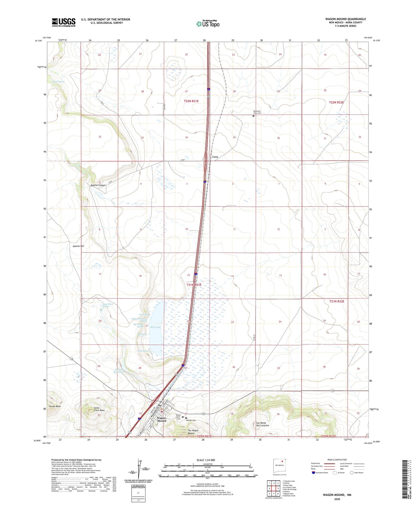
2023 topographic map quadrangle Wagon Mound in the state of New Mexico. Scale: 1:24000. Based on the newly updated USGS 7.5' US Topo map series, this map is in the following counties: Mora. The map contains contour data, water features, and other items you are used to seeing on USGS maps, but also has updated roads and other features. This is the next generation of topographic maps. Printed on high-quality waterproof paper with UV fade-resistant inks.
Quads adjacent to this one:
West: La Chata Crater
Northwest: Charette Lake
North: Colmor
Northeast: Stony Lake
East: Alto De Hormiga
Southeast: Alamosa Creek
South: Mogote Hills
Southwest: Optimo
This map covers the same area as the classic USGS quad with code o36104a6.
Contains the following named places: Apache Canyon, Apache Hill, Arroyo Puerto, Berlier Reservoir, Berlier Reservoir A Dam, Big Spring, Big Willow Spring, Coral Spring, Correo Spring, Daniels, Dead Cottonwood Spring, First Baptist Church, Health Centers of Northern New Mexico Wagon Mound Clinic, Hillside Cemetery, Julian, Las Mesas Del Conjelon, Levy, Levy Post Office, Levy Weather Station, Mountain View Cemetery, S & S Ranch Airport, Salt Lake, Santa Clara Cemetery, Santa Clara Hotel Historic Site, Santa Clara Mesa, Santa Clara Parish, Santa Clara Springs, South Spring, The Wagon Mound, Village of Wagon Mound, Wagon Mound, Wagon Mound City Marshal, Wagon Mound Elementary School, Wagon Mound High School, Wagon Mound Historical Marker, Wagon Mound Post Office, Wagon Mound Volunteer Fire Department, ZIP Code: 87752