MyTopo
Werney Hill New Mexico US Topo Map
Couldn't load pickup availability
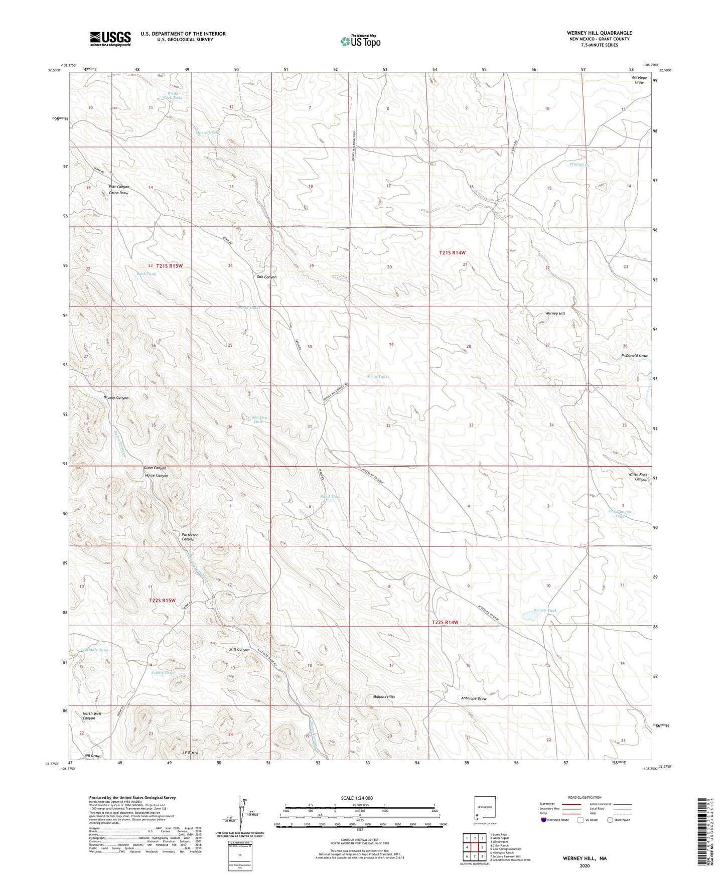
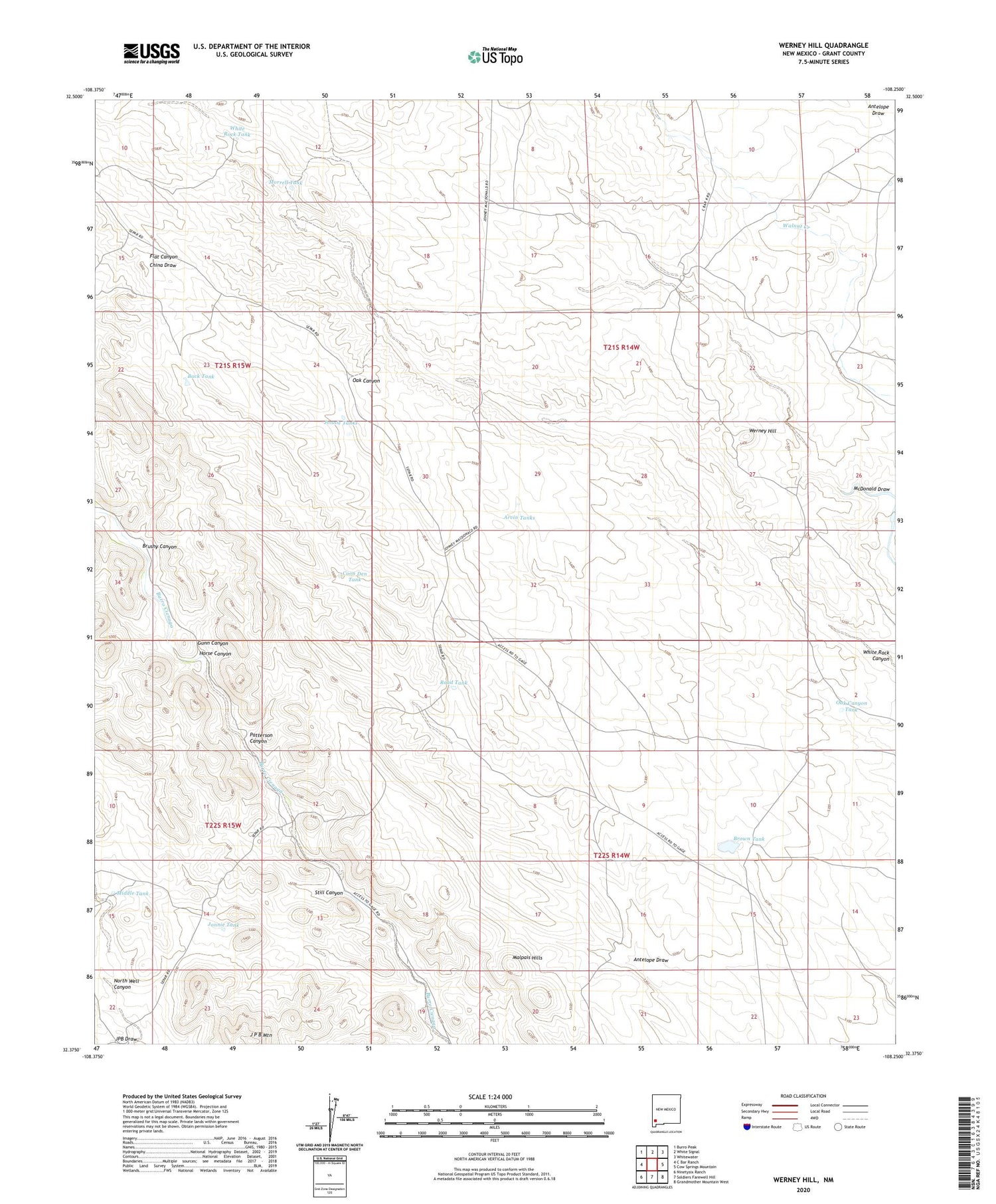
2020 topographic map quadrangle Werney Hill in the state of New Mexico. Scale: 1:24000. Based on the newly updated USGS 7.5' US Topo map series, this map is in the following counties: Grant. The map contains contour data, water features, and other items you are used to seeing on USGS maps, but also has updated roads and other features. This is the next generation of topographic maps. Printed on high-quality waterproof paper with UV fade-resistant inks.
Quads adjacent to this one:
West: C Bar Ranch
Northwest: Burro Peak
North: White Signal
Northeast: Whitewater
East: Cow Springs Mountain
Southeast: Grandmother Mountain West
South: Soldiers Farewell Hill
Southwest: Ninetysix Ranch
Contains the following named places: 00488 Water Well, 00497 Water Well, Antelope Draw, Arvin Tanks, Back Tank, Big Deeper Well, Brown Tank, Brushy Canyon, Coon Den Tank, Cottonwood Windmill, Eubank Corral, Frost Ranch, Gunn Canyon, Hinds Well, Hines Deposit, Horse Canyon, J P B Mountain, John Bull Corral, Jonnie Tank, Jonnie Tanks, Malpais Hills, McDonald Ranch, Middle Tank, Morrell Tank, Morrow Ranch, North Well Canyon, Number 472 Well, Oak Canyon Tank, Patterson Canyon, Patterson Windmill, Pete Windmill, Ray Gun Tank, Road Tank, Still Canyon, Trimmer Mine, University Tank, Werney Hill, Werney Mine, White Rock Tank