MyTopo
Burro Peak New Mexico US Topo Map
Couldn't load pickup availability
Also explore the Burro Peak Forest Service Topo of this same quad for updated USFS data
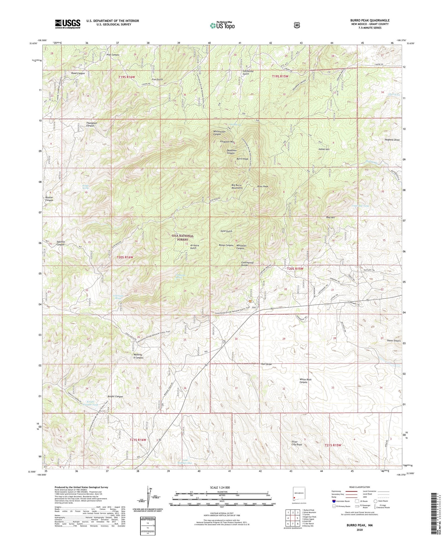
2023 topographic map quadrangle Burro Peak in the state of New Mexico. Scale: 1:24000. Based on the newly updated USGS 7.5' US Topo map series, this map is in the following counties: Grant. The map contains contour data, water features, and other items you are used to seeing on USGS maps, but also has updated roads and other features. This is the next generation of topographic maps. Printed on high-quality waterproof paper with UV fade-resistant inks.
Quads adjacent to this one:
West: Eagle Eye Peak
Northwest: Bullard Peak
North: Wind Mountain
Northeast: Tyrone
East: White Signal
Southeast: Werney Hill
South: C Bar Ranch
Southwest: Gold Hill
This map covers the same area as the classic USGS quad with code o32108e4.
Contains the following named places: 00988 Water Well, 00989 Water Well, Arrastre Windmill, Austin Amazon Mines, Burro Mountain Homestead, Burro Peak, Copeland Mine, Copeland Tank, Deadman Canyon Shafts and Prospect, Ferguson Mountain, Floyd Collins Mine, Goat Camp Windmill, Gold Gulch Placer, Gold Gulch Spring, Gold Gulch Windmill, Grapevine Spring, Hop Williams Mine, Indian Hill, Jacks Peak, John Malone Shaft, Knight Canyon Tank, KXKK-FM (Lordsburg), McCauley Ranch, Merry Widow Mine, Merry Widow Shaft, Mud Spring, Neglected Mine, Pine Canyon Windmill, Red Hill, Red Hill Turquoise Mine, Russel Ranch, Rustler Canyon, Rustler Spring, S Big Burro Mountains Euxenite Deposit, Sawmill Canyon, Section Fifteen Windmill, Shrine, Silsby Ranch, Silver Dollar Mine, Spar Hill Mine, Sprouse Mine, Summit Deposit, Sunset Gold Field, Tank Number One, Thompson Canyon Windmill, Thompson Windmill, Uncle Jimmy Thwaits Mine, Walking X Ranch, Walnut Creek Windmill, Wild Irishman Number 5 Shafts