MyTopo
C Bar Ranch New Mexico US Topo Map
Couldn't load pickup availability
Also explore the C Bar Ranch Forest Service Topo of this same quad for updated USFS data
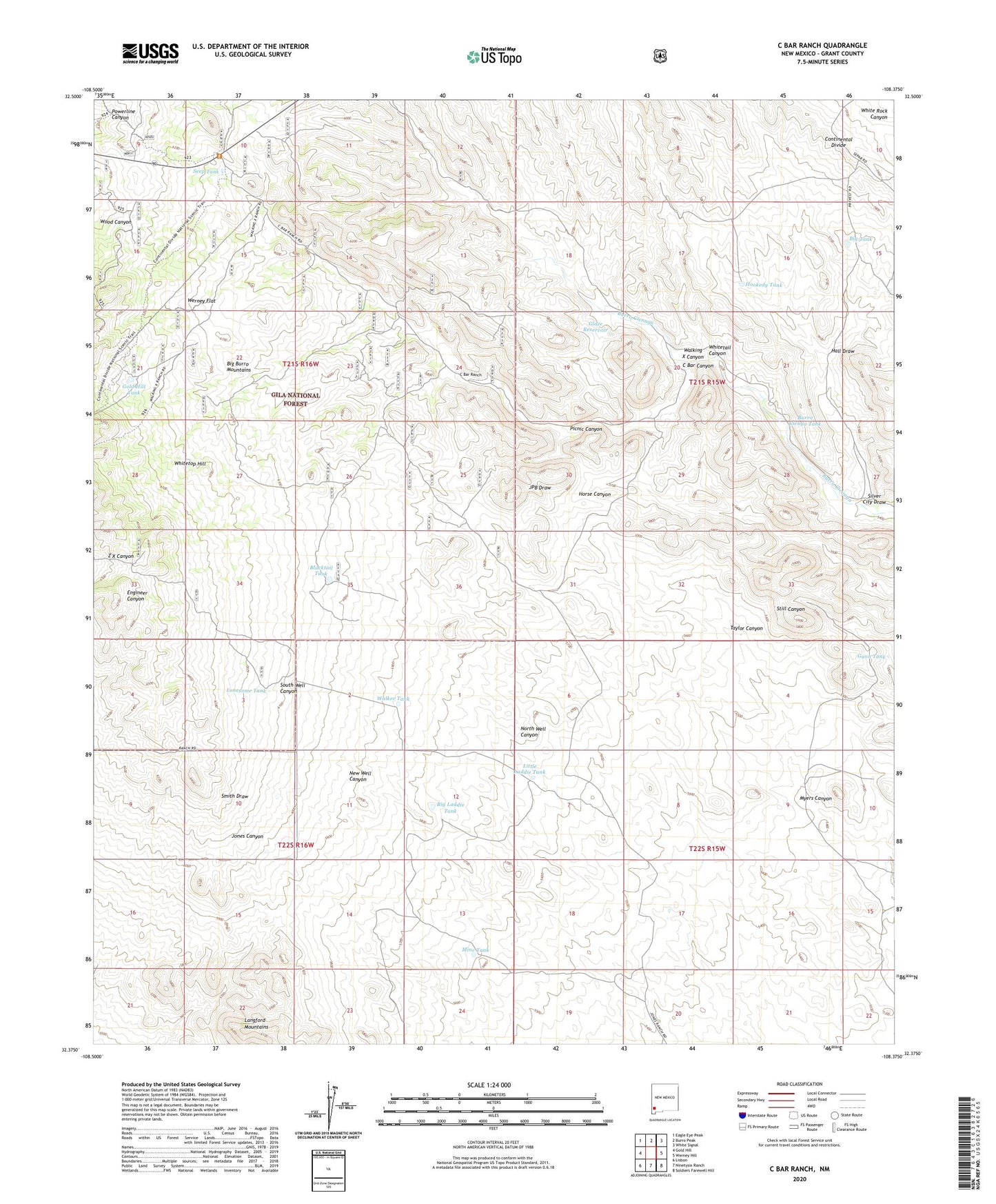
2023 topographic map quadrangle C Bar Ranch in the state of New Mexico. Scale: 1:24000. Based on the newly updated USGS 7.5' US Topo map series, this map is in the following counties: Grant. The map contains contour data, water features, and other items you are used to seeing on USGS maps, but also has updated roads and other features. This is the next generation of topographic maps. Printed on high-quality waterproof paper with UV fade-resistant inks.
Quads adjacent to this one:
West: Gold Hill
Northwest: Eagle Eye Peak
North: Burro Peak
Northeast: White Signal
East: Werney Hill
Southeast: Soldiers Farewell Hill
South: Ninetysix Ranch
Southwest: Lisbon
This map covers the same area as the classic USGS quad with code o32108d4.
Contains the following named places: American Deposit, Barrow Windmill, Big Laddie Tank, Big Tank, Blacktail Tank, Bounds Ranch, Burro Cienga Tank, C Bar Canyon, C Bar Ranch, C Bar Water Well, Double Strike Deposit, Glaze Ranch, Glaze Reservoir, Glaze Well, Gold Hill Tank, Gunn Tank, Hall Draw, Hookedy Tank, Jones Ranch, Jones Windmill, Juniper Spring Tank, Kramer Windmill, Little Laddie Tank, Little Tank, Little Windmill, Lonesome Tank, Mine Tank, Myers Canyon, Picnic Canyon, Prevost Windmill, Seep Tank, Silver City Draw, Smith Windmill, Taylor Canyon, Taylor Windmills, Walker Tank, Walking X Canyon, Werney Flat, Whitetail Canyon, Whitetop Hill, Whitetop Well, Whitetop Windmill, Willis Windmill