MyTopo
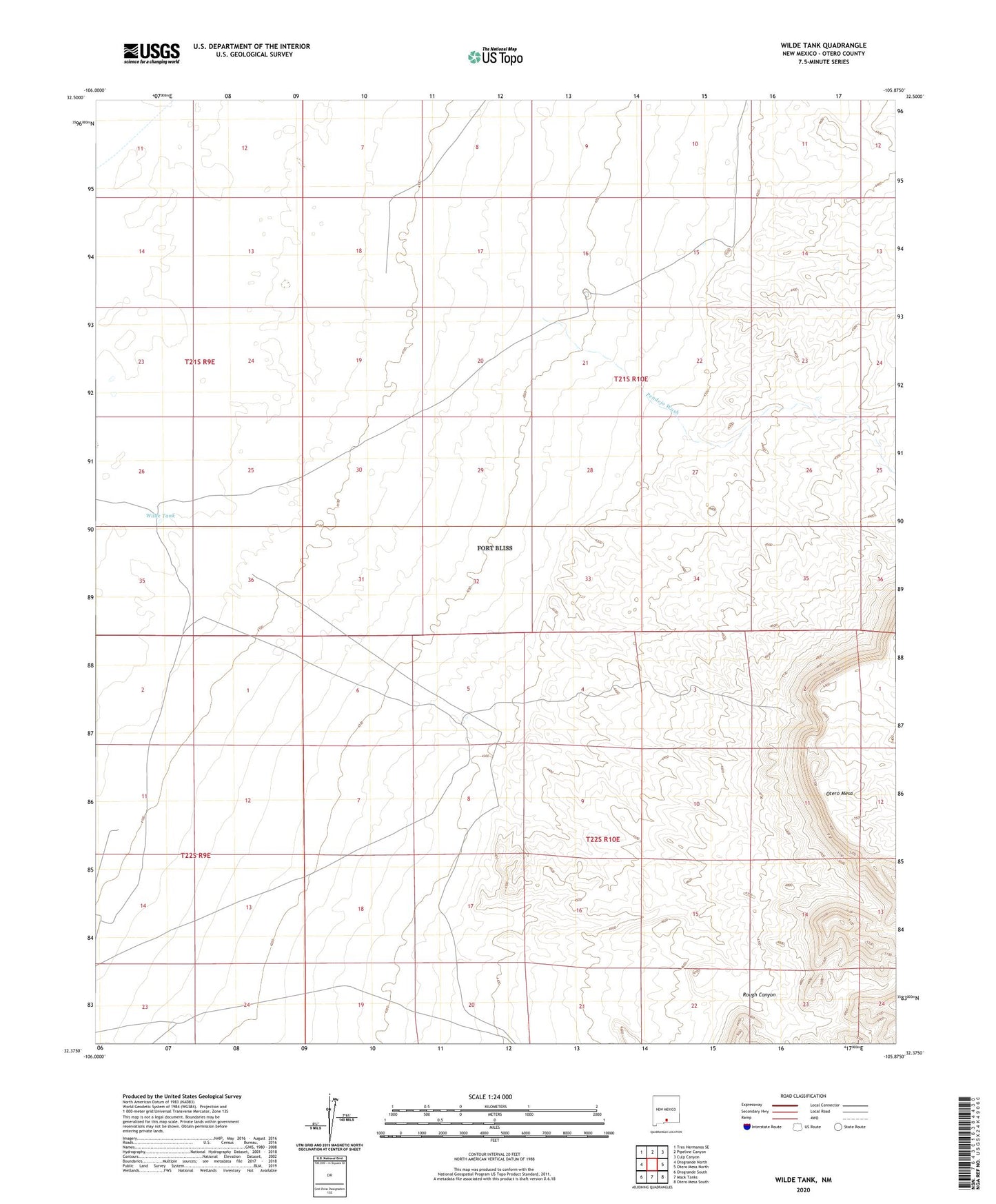
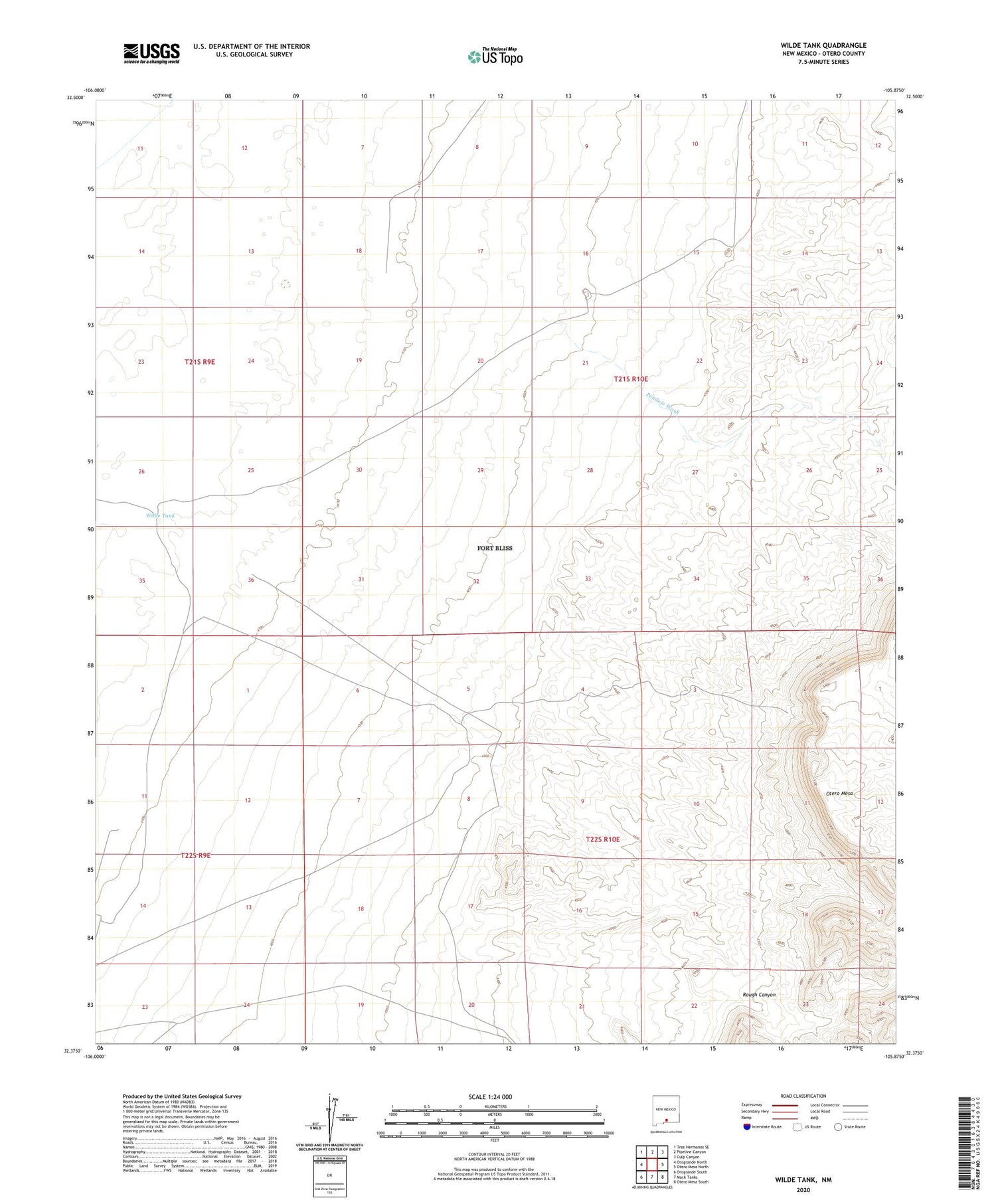
Wilde Tank New Mexico US Topo Map
Couldn't load pickup availability
2023 topographic map quadrangle Wilde Tank in the state of New Mexico. Scale: 1:24000. Based on the newly updated USGS 7.5' US Topo map series, this map is in the following counties: Otero. The map contains contour data, water features, and other items you are used to seeing on USGS maps, but also has updated roads and other features. This is the next generation of topographic maps. Printed on high-quality waterproof paper with UV fade-resistant inks.
Quads adjacent to this one:
West: Orogrande North
Northwest: Tres Hermanos SE
North: Pipeline Canyon
Northeast: Culp Canyon
East: Otero Mesa North
Southeast: Otero Mesa South
South: Mack Tanks
Southwest: Orogrande South
This map covers the same area as the classic USGS quad with code o32105d8.
Contains the following named places: CCC Tank, Lee Tank, Old Wright Place, Otero Mesa, Pendejo Tank, Pendejo Wash, Pratt Water Well, Rough Canyon, Wilde Tank, Wilde Well, Wright Tank