MyTopo
Black Mountain New Mexico US Topo Map
Couldn't load pickup availability
Also explore the Black Mountain Forest Service Topo of this same quad for updated USFS data
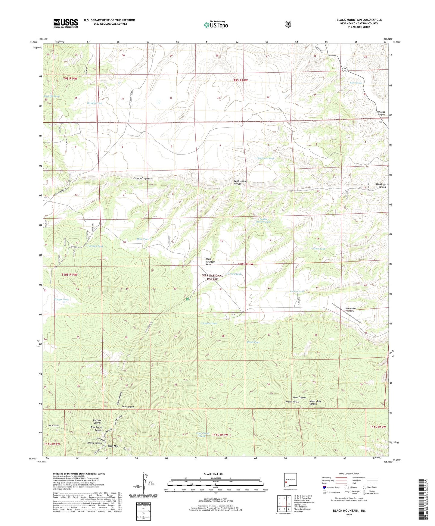
2023 topographic map quadrangle Black Mountain in the state of New Mexico. Scale: 1:24000. Based on the newly updated USGS 7.5' US Topo map series, this map is in the following counties: Catron. The map contains contour data, water features, and other items you are used to seeing on USGS maps, but also has updated roads and other features. This is the next generation of topographic maps. Printed on high-quality waterproof paper with UV fade-resistant inks.
Quads adjacent to this one:
West: Canyon Creek Mountains
Northwest: O Bar O Canyon West
North: O Bar O Canyon East
Northeast: Indian Peaks West
East: Spring Canyon
Southeast: Wall Lake
South: Burnt Corral Canyon
Southwest: Woodland Park
This map covers the same area as the classic USGS quad with code o33108d2.
Contains the following named places: Armijo Tank, Beaver Points, Beaverhead Airstrip, Birthday Windmill, Black Mountain, Black Mountain Lookout, Black Mountain Mesa, Black Spring, Buckhorn Tank, Cooney Canyon, Double Header Tank, Elmo Tank, Gap Tank, Houghton Water Well, Houghton Windmill, Jordan Tank, Lucero Tank, Mesa Tank, Perdido Tank, Railroad Canyon, Ranger Tank, Reeds Tank, Trail Tank, Trap Corral Tank, White Tank, Wolf Hollow Canyon