MyTopo
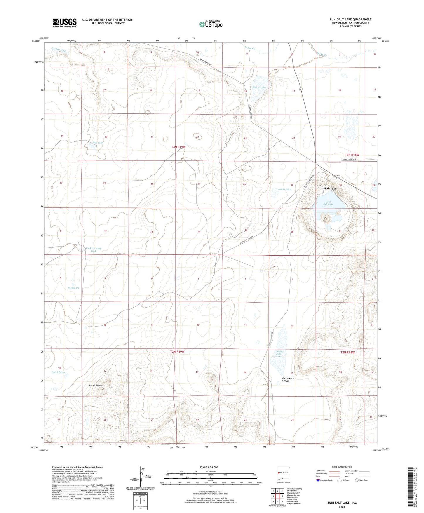
Zuni Salt Lake New Mexico US Topo Map
Couldn't load pickup availability
2023 topographic map quadrangle Zuni Salt Lake in the state of New Mexico. Scale: 1:24000. Based on the newly updated USGS 7.5' US Topo map series, this map is in the following counties: Catron. The map contains contour data, water features, and other items you are used to seeing on USGS maps, but also has updated roads and other features. This is the next generation of topographic maps. Printed on high-quality waterproof paper with UV fade-resistant inks.
Quads adjacent to this one:
West: Salazar Canyon
Northwest: Twentytwo Spring
North: Moreno Hill
Northeast: Fence Lake SW
East: Lake Armijo
Southeast: Tejana Mesa SW
South: Blaines Lake
Southwest: Goat Spring
This map covers the same area as the classic USGS quad with code o34108d7.
Contains the following named places: Ahayu:t an Yalanne, Cheap John Lake, Chical Lake, Cottonwood Canyon, Davila Well, Dutch Lakes, Ikes Tank, Layton Number 3 Water Well, Layton Number 4 Water Well, Leon Windmill, Lunas Lake, Mesita Blanca, Mesita Blanca Wilderness Study Area, Mireles Windmill, Richey Pit, Rock Chimney Tank, Salt Lake, Salt Lake Post Office, Zuni Salt Lake, Zuni Salt Lake Mine