MyTopo
Blaines Lake New Mexico US Topo Map
Couldn't load pickup availability
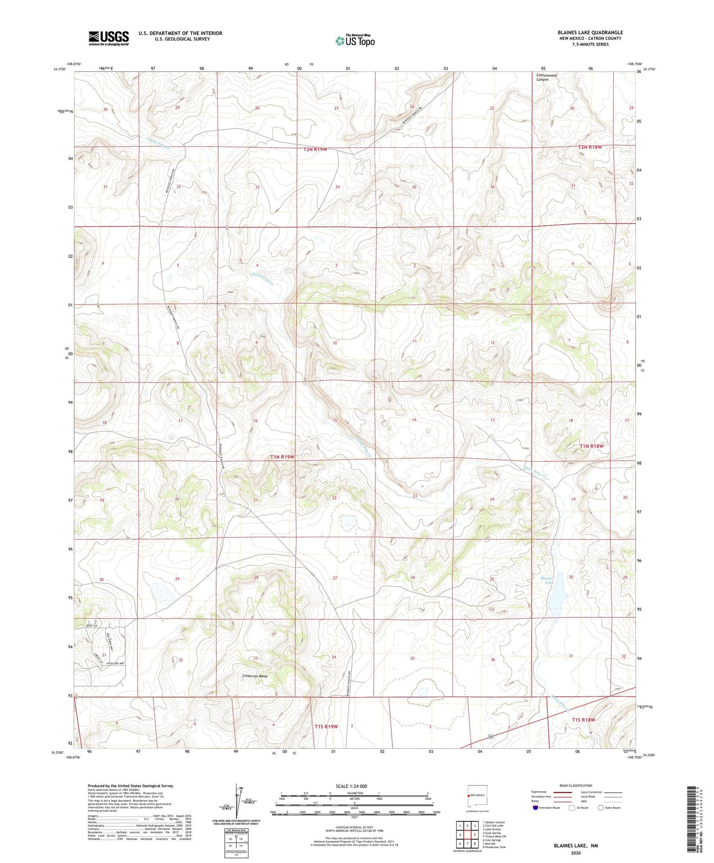
2023 topographic map quadrangle Blaines Lake in the state of New Mexico. Scale: 1:24000. Based on the newly updated USGS 7.5' US Topo map series, this map is in the following counties: Catron. The map contains contour data, water features, and other items you are used to seeing on USGS maps, but also has updated roads and other features. This is the next generation of topographic maps. Printed on high-quality waterproof paper with UV fade-resistant inks.
Quads adjacent to this one:
West: Goat Spring
Northwest: Salazar Canyon
North: Zuni Salt Lake
Northeast: Lake Armijo
East: Tejana Mesa SW
Southeast: Ponderosa Tank
South: Red Hill
Southwest: Cow Springs
This map covers the same area as the classic USGS quad with code o34108c7.
Contains the following named places: Blaines Lake, Cajon Well, Cimarron Mesa, Layton Detention Dam Number 4, Perea Dam, Red Hill Detention Dam Number One