MyTopo
Livingstonville New York US Topo Map
Couldn't load pickup availability
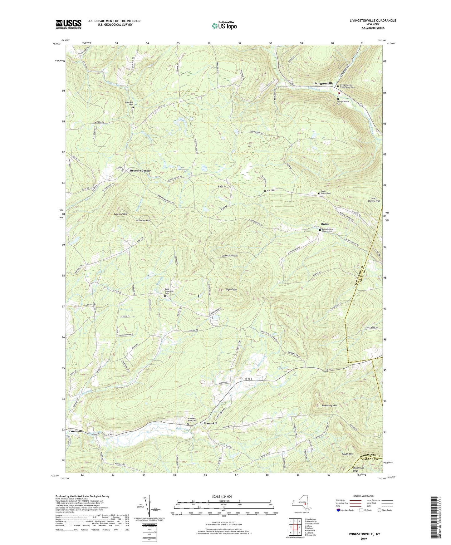
2023 topographic map quadrangle Livingstonville in the state of New York. Scale: 1:24000. Based on the newly updated USGS 7.5' US Topo map series, this map is in the following counties: Schoharie, Albany, Greene. The map contains contour data, water features, and other items you are used to seeing on USGS maps, but also has updated roads and other features. This is the next generation of topographic maps. Printed on high-quality waterproof paper with UV fade-resistant inks.
Quads adjacent to this one:
West: Gilboa
Northwest: Breakabeen
North: Middleburgh
Northeast: Rensselaerville
East: Durham
Southeast: Hensonville
South: Ashland
Southwest: Prattsville
This map covers the same area as the classic USGS quad with code o42074d3.
Contains the following named places: Bates, Bates Hollow Church Cemetery, Black Brook, Broome Center, Broome Volunteer Fire Department, East Conesville Cemetery, Ellis Cemetery, High Knob, Hubbard Hill, Keyserkill Cemetery, Lake Creek, Leonard Hill, Livingstonville, Livingstonville Cemetery, Livingstonville Presbyterian Cemetery, Manorkill, Manorkill Rural Cemetery, Richtmyer Peak, School Number 12, School Number 3, School Number 6, School Number 8, School Number 9, Scott Patent Cemetery, Scott Patent Church, Scott Patent Hill, Steenburg Mountain, Town of Conesville