MyTopo
Ashwood New York US Topo Map
Couldn't load pickup availability
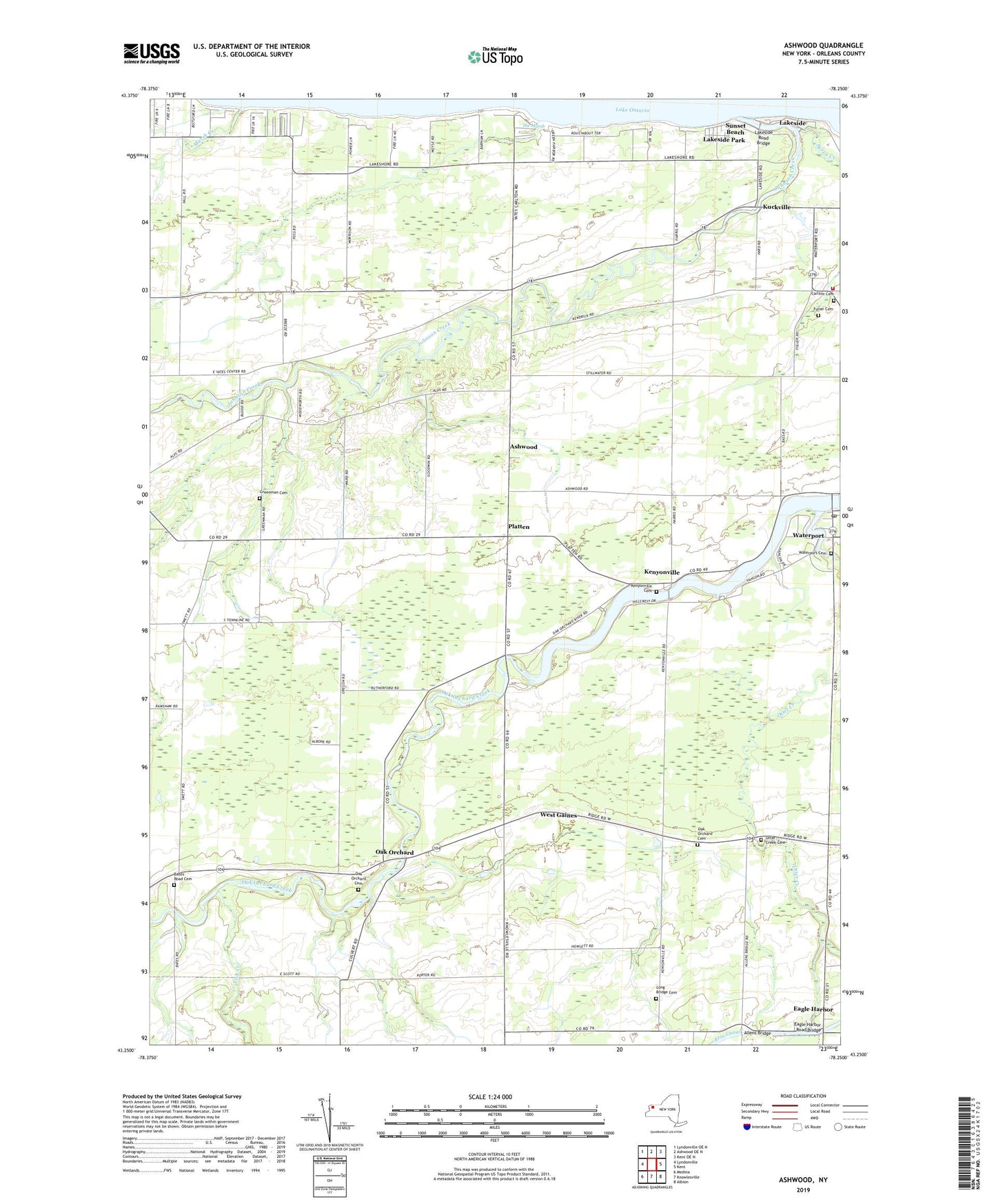
2023 topographic map quadrangle Ashwood in the state of New York. Scale: 1:24000. Based on the newly updated USGS 7.5' US Topo map series, this map is in the following counties: Orleans. The map contains contour data, water features, and other items you are used to seeing on USGS maps, but also has updated roads and other features. This is the next generation of topographic maps. Printed on high-quality waterproof paper with UV fade-resistant inks.
Quads adjacent to this one:
West: Lyndonville
Northwest: Lyndonville OE N
North: Ashwood OE N
Northeast: Kent OE N
East: Kent
Southeast: Albion
South: Knowlesville
Southwest: Medina
This map covers the same area as the classic USGS quad with code o43078c3.
Contains the following named places: Allens Bridge, Ashwood, Ashwood Wesleyan Church, Bates Road Cemetery, Carlton Cemetery, Carlton Fire Company, Eagle Harbor, Eagle Harbor Road Bridge, Eagle Harbor United Methodist Church, Fish Creek, Fuller Cemetery, Giltner Farms, Green Harbor Marina, Greenman Cemetery, Imburgia Farms, Johnson Creek, Kenyonville, Kenyonville Cemetery, Kniland Dairy Farms, Kuckville, Lakeside, Lakeside Park, Lakeside Road Bridge, Long Bridge Cemetery, Lynoaken Farm, Marsh Creek, Navarra Farm and Greenhouse, Nice Farms, Oak Orchard, Oak Orchard Assembly of God, Oak Orchard Cemetery, Otter Creek, Otter Creek Cemetery, Platten, Rocky Haven Farm, Sandy Knoll Farms, School Number 11, School Number 12, School Number 15, School Number 16, School Number 18, School Number 3, School Number 6, School Number 7, Sunset Beach, Syren Creek, The Marsh, Waterport, Waterport Cemetery, Waterport Pond, Waterport Post Office, West Gaines, ZIP Code: 14571