MyTopo
Beekmantown New York US Topo Map
Couldn't load pickup availability
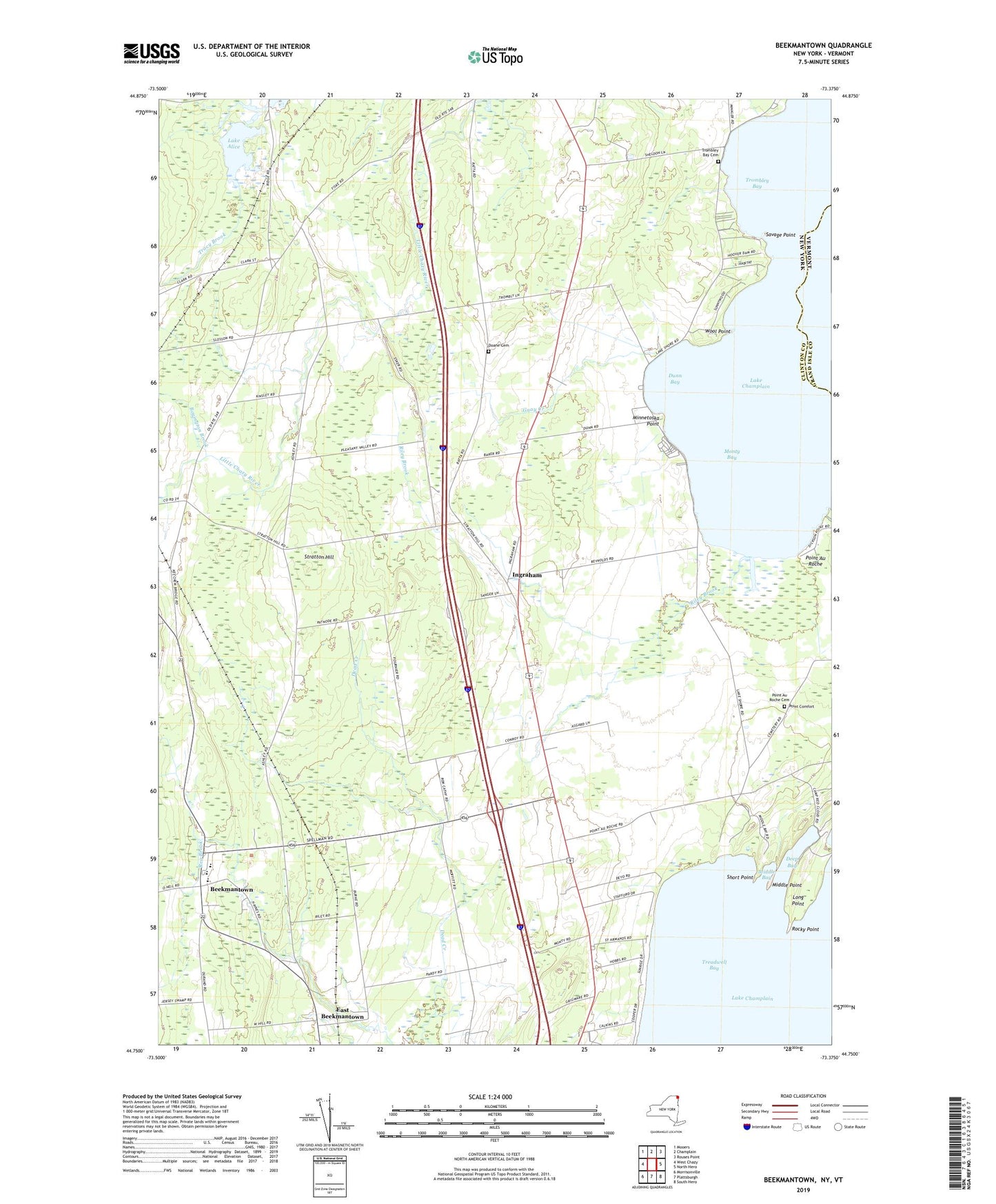
2023 topographic map quadrangle Beekmantown in the state of New York. Scale: 1:24000. Based on the newly updated USGS 7.5' US Topo map series, this map is in the following counties: Clinton, Grand Isle. The map contains contour data, water features, and other items you are used to seeing on USGS maps, but also has updated roads and other features. This is the next generation of topographic maps. Printed on high-quality waterproof paper with UV fade-resistant inks.
Quads adjacent to this one:
West: West Chazy
Northwest: Mooers
North: Champlain
Northeast: Rouses Point
East: North Hero
Southeast: South Hero
South: Plattsburgh
Southwest: Morrisonville
Contains the following named places: Allen School, Barnes School, Beekman Lane Farms, Beekmantown, Beekmantown Northbound Rest Area, Beekmantown Southbound Rest Area, Boyington Brook, Bubbins Farm, Clearfield Farm, Deep Bay, Doane Cemetery, Dunn Bay, East Beekmantown, Giroux's Poultry Farm, Gregware Dairy Farm, Guay Creek, Hays School, Ingraham, Lake Alice, Long Point, Mar-lyn Farms, Middle Bay, Middle Point, Minnetoska Point, Monty Bay, Monty's Bay Campsites, Point Au Roche, Point Au Roche Cemetery, Point au Roche Church, Point Comfort, Riley Brook, Rocky Point, Saint Armand Beach, Savage Point, Short Point, Stratton Hill, Stratton Hill School, Town of Beekmantown, Town of Chazy, Treadwell Bay, Trombley Bay, Trombley Bay Cemetery, Wool Point