MyTopo
Morrisonville New York US Topo Map
Couldn't load pickup availability
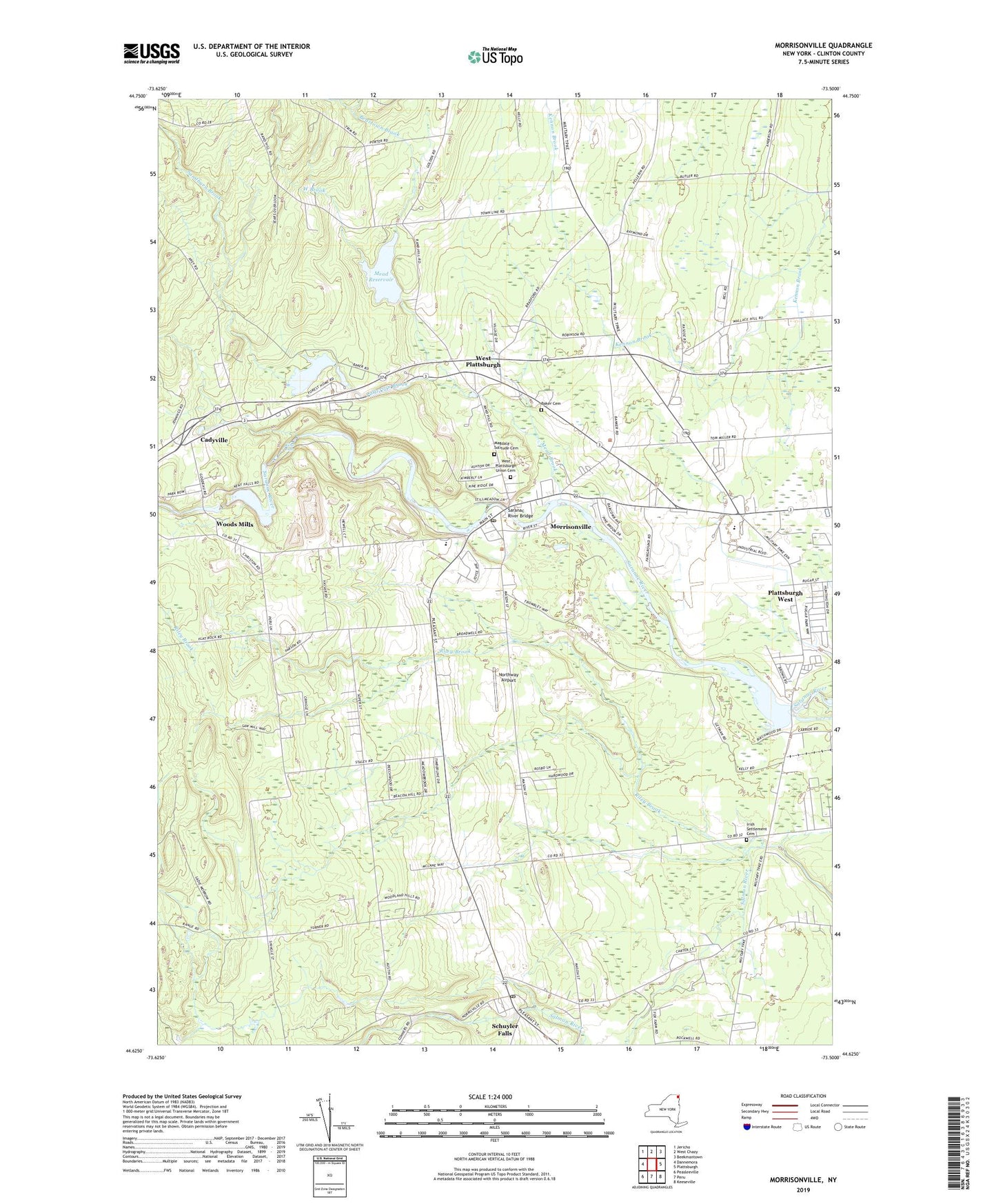
2023 topographic map quadrangle Morrisonville in the state of New York. Scale: 1:24000. Based on the newly updated USGS 7.5' US Topo map series, this map is in the following counties: Clinton. The map contains contour data, water features, and other items you are used to seeing on USGS maps, but also has updated roads and other features. This is the next generation of topographic maps. Printed on high-quality waterproof paper with UV fade-resistant inks.
Quads adjacent to this one:
West: Dannemora
Northwest: Jericho
North: West Chazy
Northeast: Beekmantown
East: Plattsburgh
Southeast: Keeseville
South: Peru
Southwest: Peasleeville
This map covers the same area as the classic USGS quad with code o44073f5.
Contains the following named places: Adcott Pit, Baker Cemetery, Banker Road Industrial Park, Beartown Brook, Beckwith School, Bread of Life Baptist Church, Castine Farms, Clinton County Airport, Clinton County Landfill, Clinton State Forest, Country Dreams Farm, District School Number 11, District School Number 15, District School Number 2, District School Number 3, District School Number 7, Everett Orchards, Four Seasons Mobile Home Park, Irish Settlement Cemetery, Kent Falls, Kent Falls Hydro-Electric Plant, Kingdom Hall of Jehovahs Witnesses, Magdala Solitude Cemetery, Mead Brook, Mead Reservoir, Morrisonville, Morrisonville Armory, Morrisonville Census Designated Place, Morrisonville Community Church, Morrisonville Elementary School, Morrisonville Post Office, Morrisonville Schuyler Falls Volunteer Ambulance Service, Mountain View Airpark, Northway Airport, Patterson Brook, Patterson Reservoir, Plattsburgh Drive-In, Plattsburgh West Census Designated Place, Pytlak Orchards, Rand Hill School, Riley Brook, Saint Alexanders School, Saint Joseph Church, Sandburn Brook, Saranac River Bridge, Schuyler Falls, Schuyler Falls Post Office, Schuyler Falls Town Hall, Scribner Pond, Town of Plattsburgh, Town of Schuyler Falls, Turnpike Wesleyan Church, Wesleyan Church, West Brook, West Plattsburgh, West Plattsburgh Union Cemetery, Woods Mills, ZIP Code: 12962