MyTopo
Mooers New York US Topo Map
Couldn't load pickup availability
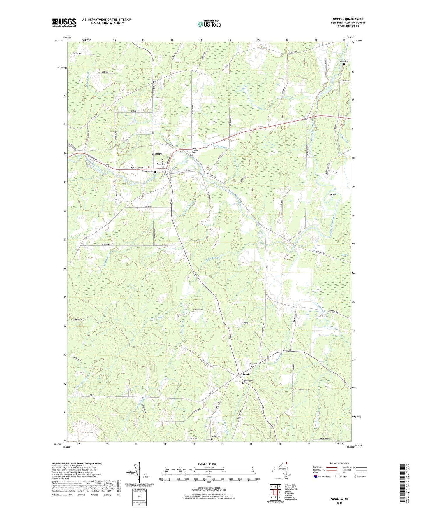
2023 topographic map quadrangle Mooers in the state of New York. Scale: 1:24000. Based on the newly updated USGS 7.5' US Topo map series, this map is in the following counties: Clinton. The map contains contour data, water features, and other items you are used to seeing on USGS maps, but also has updated roads and other features. This is the next generation of topographic maps. Printed on high-quality waterproof paper with UV fade-resistant inks.
Quads adjacent to this one:
West: Altona
Northwest: Altona OE N
North: Mooers OE N
Northeast: Champlain OE N
East: Champlain
Southeast: Beekmantown
South: West Chazy
Southwest: Jericho
This map covers the same area as the classic USGS quad with code o44073h5.
Contains the following named places: Bullis Brook, Dragoon Cemetery, Jennett Cemetery, Lake Alice State Game Management Area, Larato Farms, Mills Cemetery, Mooers, Mooers Camp Meeting Association, Mooers Census Designated Place, Mooers Elementary School, Mooers Free Library, Mooers Post Office, Mooers Quarry, Mooers United Methodist Church, Mooers Wesleyan Church, Oxbow, Riverside Cemetery, Saint Josephs Cemetery, Saint Josephs Church, Saint Louis de France Church, Sciola, Shedden Brook, Sperry Brook, Stone Cemetery, The Vly, Twin Bridges, ZIP Code: 12958