MyTopo
Reading Center New York US Topo Map
Couldn't load pickup availability
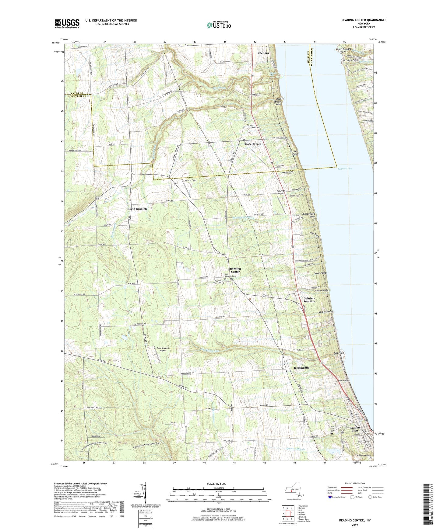
2023 topographic map quadrangle Reading Center in the state of New York. Scale: 1:24000. Based on the newly updated USGS 7.5' US Topo map series, this map is in the following counties: Schuyler, Yates. The map contains contour data, water features, and other items you are used to seeing on USGS maps, but also has updated roads and other features. This is the next generation of topographic maps. Printed on high-quality waterproof paper with UV fade-resistant inks.
Quads adjacent to this one:
West: Wayne
Northwest: Keuka Park
North: Dundee
Northeast: Lodi
East: Burdett
Southeast: Montour Falls
South: Beaver Dams
Southwest: Bradford
This map covers the same area as the classic USGS quad with code o42076d8.
Contains the following named places: Arcadian Estate Vineyards, Barnes Station, Big Hollow Run, Big Stream, Bullhorn Creek, Buttonwood Brook, Buttonwood Point, Cascata Winery, Castel Grisch Winery, Chapman Corners, Coal Point, Coles Corners, Corbett Point, County Line Cemetery, Fir Tree Point, Four Seasons Airport, Fox Run Golf Course, Fulkersons Winery, Gabriels Junction, Gingerbread Corners, Glen Baptist Church, Glenora, Glenora Falls, Glenora Wine Cellars, Greenwood Cemetery, Halls Corners, Inwood Point, Irelandville, Lakewood Vineyards, McGrath Point, North Reading, Old Reading Cemetery, Padua High School, Peach Orchard Point, Pleasant View Cemetery, Quarter Mile Creek, Reading Center, Reading Center Post Office, Reading Center Station, Re-Dun Field, Rock Stream, Rock Stream Cemetery, Rock Stream Point, Rock Stream Post Office, Salt Point, Sawmill Creek, Schuyler Airport, Schuyler County, Scout Point, Spring Ledge Farms, Town of Reading, Watkins Glen Golf Course, ZIP Codes: 14878, 14891