MyTopo
Bristol Center New York US Topo Map
Couldn't load pickup availability
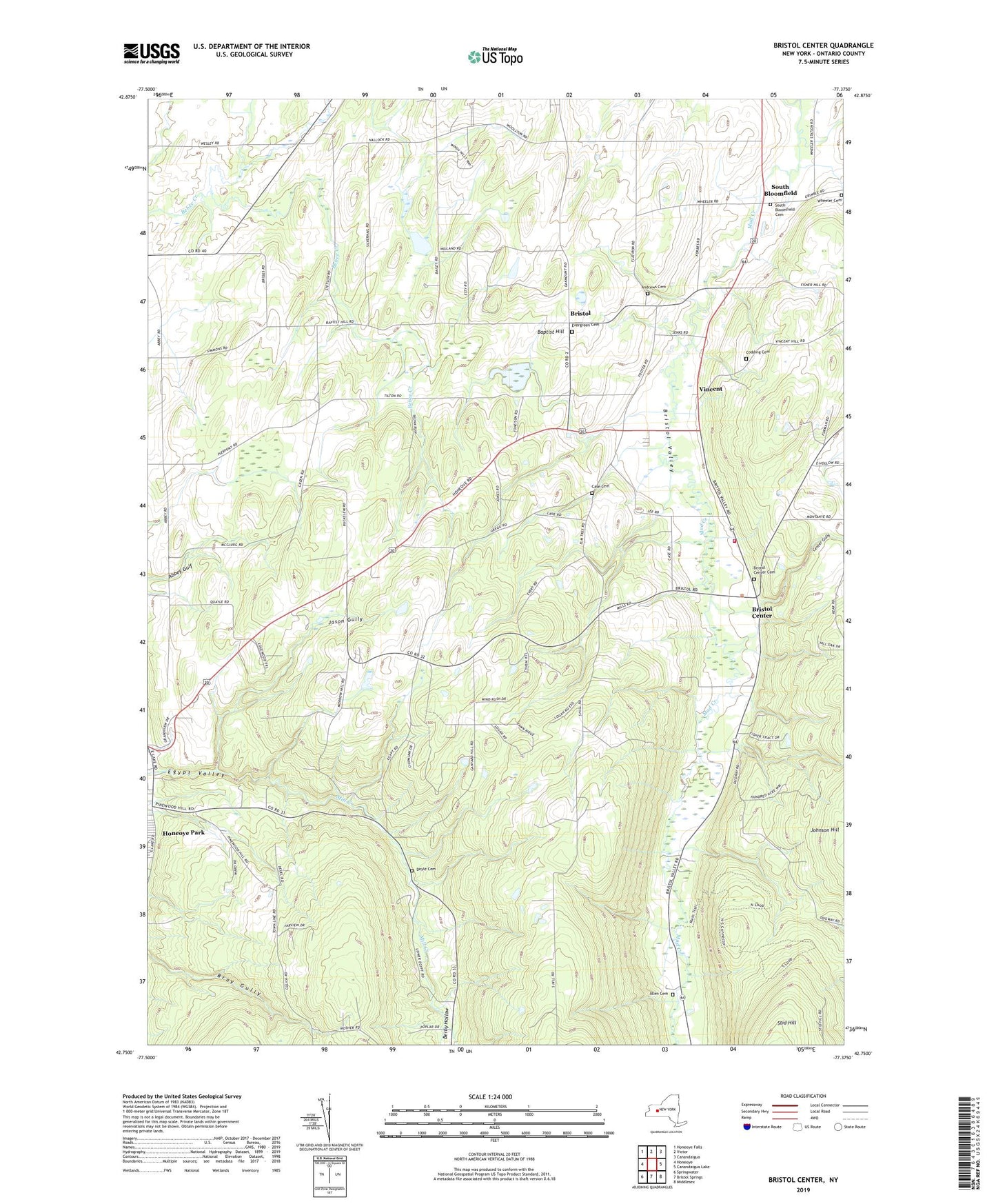
2023 topographic map quadrangle Bristol Center in the state of New York. Scale: 1:24000. Based on the newly updated USGS 7.5' US Topo map series, this map is in the following counties: Ontario. The map contains contour data, water features, and other items you are used to seeing on USGS maps, but also has updated roads and other features. This is the next generation of topographic maps. Printed on high-quality waterproof paper with UV fade-resistant inks.
Quads adjacent to this one:
West: Honeoye
Northwest: Honeoye Falls
North: Victor
Northeast: Canandaigua
East: Canandaigua Lake
Southeast: Middlesex
South: Bristol Springs
Southwest: Springwater
This map covers the same area as the classic USGS quad with code o42077g4.
Contains the following named places: Allen Cemetery, Andrews Cemetery, Baptist Hill, Berby Hollow, Bristol, Bristol Center, Bristol Center Cemetery, Bristol Town Hall, Bristol Valley, Bristol Valley Church, Bristol Volunteer Fire Department, Bristol Woodlands Campground, Case Cemetery, Center Gully, Codding Cemetery, Doyle Cemetery, Egypt Valley, Evergreen Cemetery, Fletcher Corners, Gladding Corner, Jason Gully, Mayweed Corner, Ontario County Fair Grounds, Pilgrim Bible Church of Bristol, Randall Gully, Reed Gully, School Number 10, School Number 12, School Number 2, School Number 3, School Number 4, School Number 5, School Number 6, School Number 8, School Number 9, South Bloomfield, South Bloomfield Cemetery, Speakers Corner, Town of Bristol, Vincent, Wheeler Cemetery, WZSH-FM (Town of South Bristol), ZIP Code: 14471