MyTopo
Burke New York US Topo Map
Couldn't load pickup availability
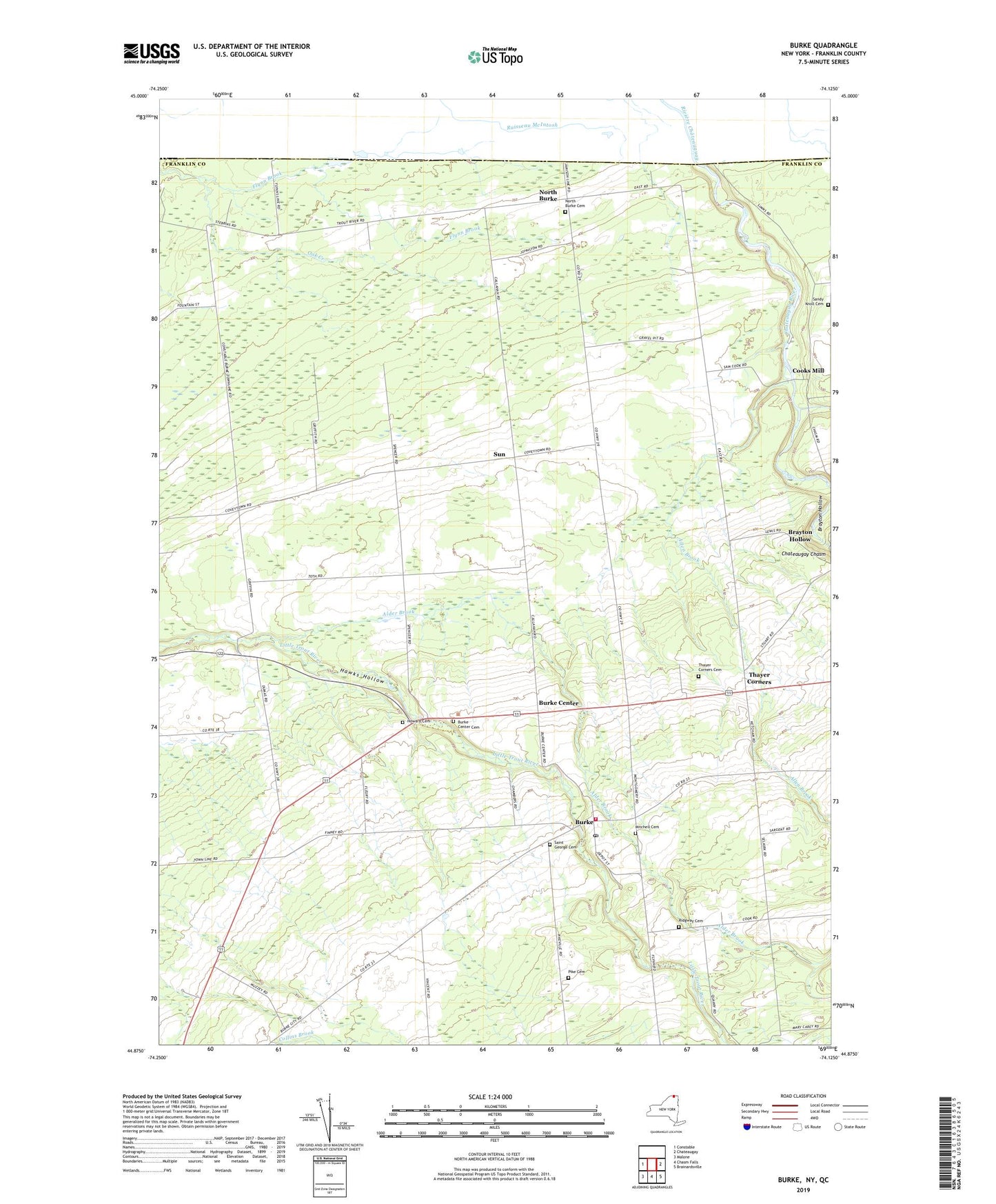
2023 topographic map quadrangle Burke in the state of New York. Scale: 1:24000. Based on the newly updated USGS 7.5' US Topo map series, this map is in the following counties: Franklin. The map contains contour data, water features, and other items you are used to seeing on USGS maps, but also has updated roads and other features. This is the next generation of topographic maps. Printed on high-quality waterproof paper with UV fade-resistant inks.
Quads adjacent to this one:
West: Constable
East: Chateaugay
Southeast: Brainardsville
South: Chasm Falls
Southwest: Malone
This map covers the same area as the classic USGS quad with code o44074h2.
Contains the following named places: Alder Brook, Allen Brook, Brayton Hollow, Burke, Burke Center, Burke Center Cemetery, Burke Post Office, Burke United Methodist Church, Burke Volunteer Fire Department, Cooks Mill, Coveytown Corners, Fee School, Flynn Brook, Hawks Hollow, Howard Cemetery, Marble River, Mitchell Cemetery, North Burke, North Burke Cemetery, Percy Campground, Pike Cemetery, Ridgway Cemetery, Saint George Cemetery, Saint George's Church, Sandy Knoll Cemetery, School Number 11, School Number 13, School Number 14, School Number 15, School Number 17, School Number 3, School Number 5, School Number 7, School Number 9, Sellers Field, Sun, Thayer Corners, Thayer Corners Cemetery, Town of Burke, Village of Burke, ZIP Code: 12917