MyTopo
Jewell New York US Topo Map
Couldn't load pickup availability
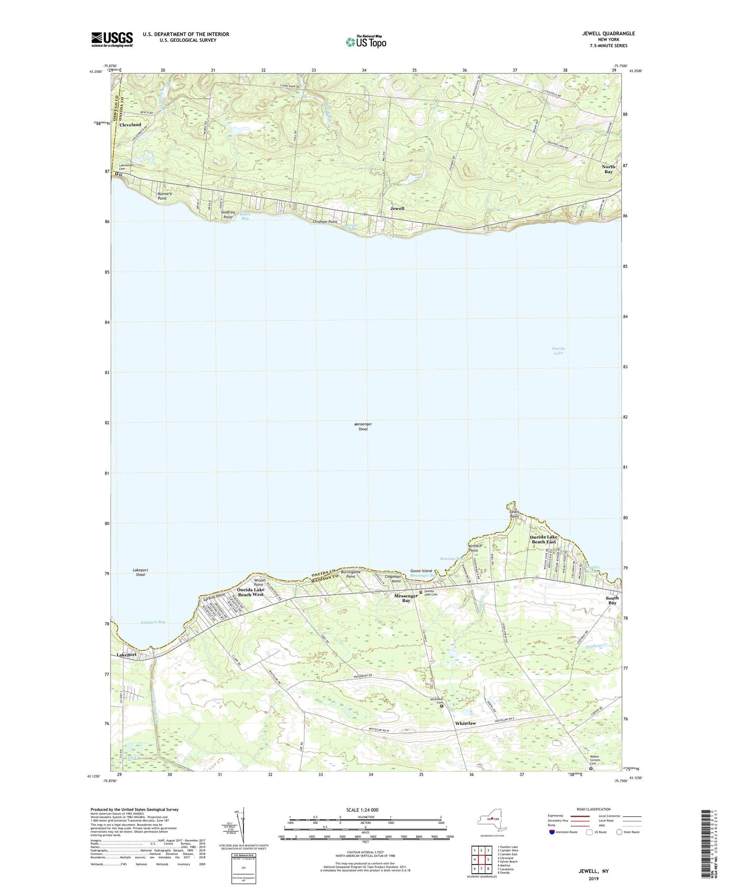
2023 topographic map quadrangle Jewell in the state of New York. Scale: 1:24000. Based on the newly updated USGS 7.5' US Topo map series, this map is in the following counties: Oneida, Madison, Oswego. The map contains contour data, water features, and other items you are used to seeing on USGS maps, but also has updated roads and other features. This is the next generation of topographic maps. Printed on high-quality waterproof paper with UV fade-resistant inks.
Quads adjacent to this one:
West: Cleveland
Northwest: Panther Lake
North: Camden West
Northeast: Camden East
East: Sylvan Beach
Southeast: Oneida
South: Canastota
Southwest: Manlius
This map covers the same area as the classic USGS quad with code o43075b7.
Contains the following named places: Burlingame Point, Canaseraga Creek, Chapman Point, Chishom Point, Cowaselon Creek, Eaton Bay, Gees Corner, Gifford Point, Godfrey Point, Goose Island, Hall Brook, Hall Corners, Hughes Harbor, Jewell, Kawana Bay, Kinloch Point, Lakeport, Lakeport Bay, Lakeport Chapel, Lakeport Shoal, Lakewood Cemetery, Larkins Point, Lewis Point, Long Crossing, Loomis Corners, Mead Creek, Messenger Bay, Messenger Shoal, Miller Airport, North Bay Area School, Nunnery Point, Oneida Lake Beach East, Oneida Lake Beach West, Oneida Lake Cemetery, Oneida Lake Church, Oneido Lake Marina, Pier Number 31 Marina, Saint Mary's Cemetery, Town of Vienna, Vly Creek, Walker's Corners Cemetery, Whitelaw, Whitelaw Cemetery, Willow Run Mobile Home Park, Wilson Point, ZIP Code: 13123