MyTopo
Cossayuna New York US Topo Map
Couldn't load pickup availability
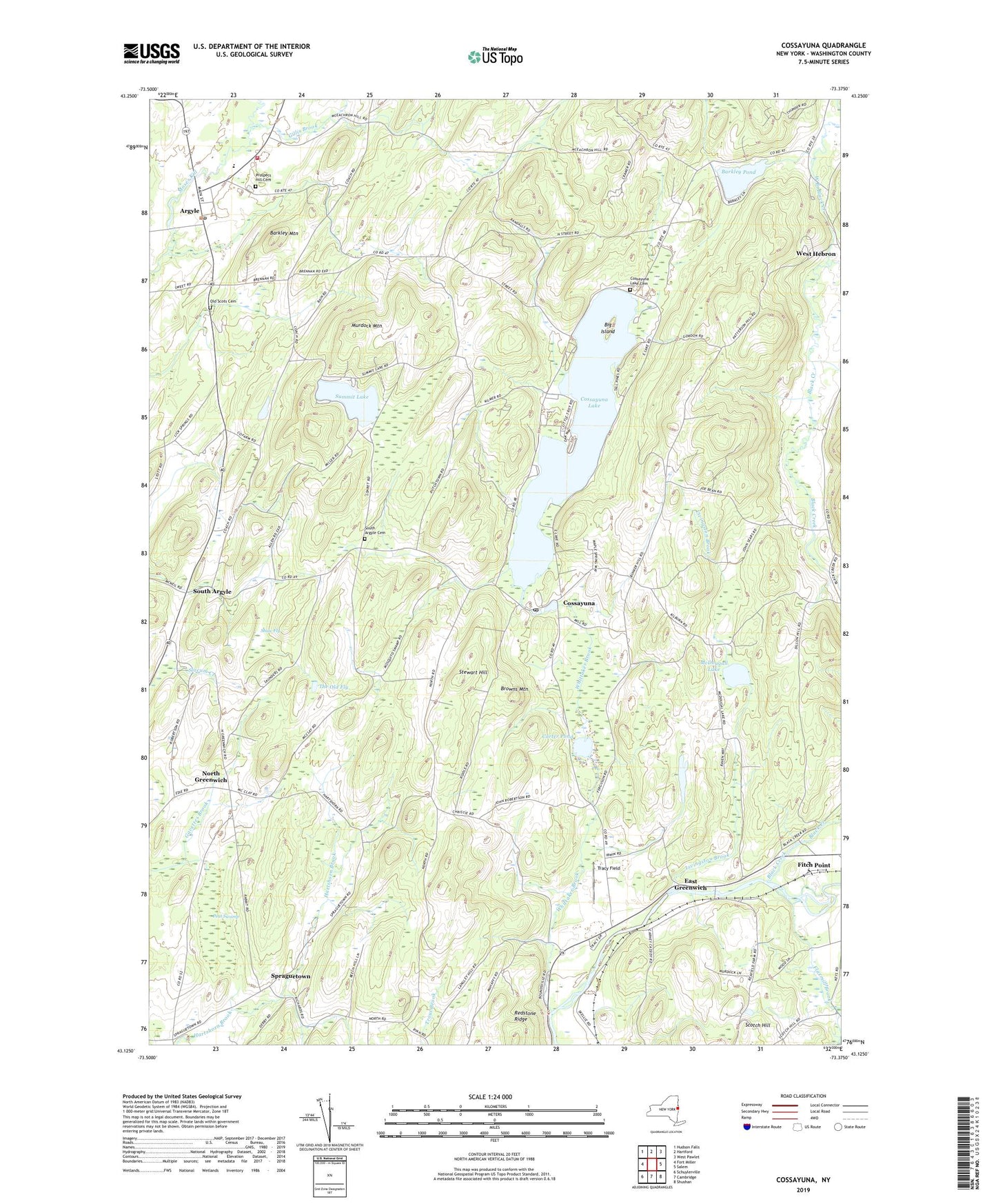
2019 topographic map quadrangle Cossayuna in the state of New York. Scale: 1:24000. Based on the newly updated USGS 7.5' US Topo map series, this map is in the following counties: Washington. The map contains contour data, water features, and other items you are used to seeing on USGS maps, but also has updated roads and other features. This is the next generation of topographic maps. Printed on high-quality waterproof paper with UV fade-resistant inks.
Quads adjacent to this one:
West: Fort Miller
Northwest: Hudson Falls
North: Hartford
East: Salem
Southeast: Shushan
South: Cambridge
Southwest: Schuylerville
Contains the following named places: Argyle, Argyle Central School, Argyle Emergency Squad, Argyle Fire and Rescue, Argyle Fire Rescue Department, Argyle Free Library, Argyle Post Office, Argyle United Methodist Church, Argyle United Presbyterian Church, Barkley Mountain, Barkley Pond, Beech Hill Farm, Beech Hill School, Big Island, Black Creek, Browns Mountain, Butternut Ridge Farms, Carter Pond, Carters Pond State Wildlife Management Area, Cossayuna, Cossayuna Lake, Cossayuna Lake Cemetery, Cossayuna Post Office, East Greenwich, Fitch Point, Flaxmill Brook, Gillis Brook, Highland Maple Farm, Livingston Brook, MacClan Farms, Mapleland Farm, McDougall Lake, Murdock Mountain, North Greenwich, Old Scots Cemetery, Peat Swamp, Pleasant Valley Adult Home, Prospect Hill Cemetery, Rock Hill School, Scotch Hill, Shaw Fly, South Argyle, South Argyle Cemetery, Spraguetown, Star Ridge Farm, Stewart Hill, Summit Lake, The Old Fly, Town of Argyle, Town of Greenwich, Tracy Field, Village of Argyle, West Branch Black Creek, West Hebron, Whittaker Brook, ZIP Codes: 12809, 12823