MyTopo
Cambridge New York US Topo Map
Couldn't load pickup availability
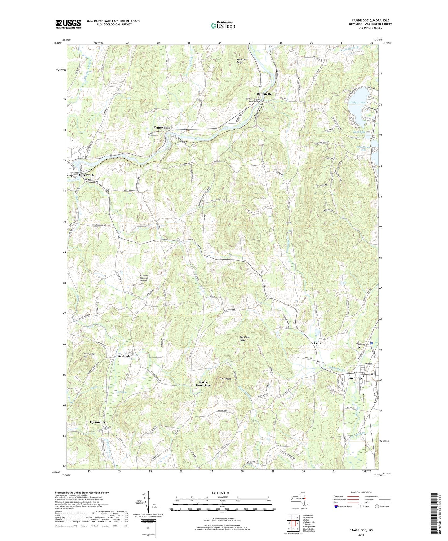
2023 topographic map quadrangle Cambridge in the state of New York. Scale: 1:24000. Based on the newly updated USGS 7.5' US Topo map series, this map is in the following counties: Washington. The map contains contour data, water features, and other items you are used to seeing on USGS maps, but also has updated roads and other features. This is the next generation of topographic maps. Printed on high-quality waterproof paper with UV fade-resistant inks.
Quads adjacent to this one:
West: Schuylerville
Northwest: Fort Miller
North: Cossayuna
Northeast: Salem
East: Shushan
Southeast: Hoosick Falls
South: Eagle Bridge
Southwest: Schaghticoke
This map covers the same area as the classic USGS quad with code o43073a4.
Contains the following named places: Archdale, Archdale Meadows Airport, Batten - Dugan Road Bridge, Battenville, Bottskill Baptist Church, Cambridge, Cambridge Central School, Cambridge Creek, Cambridge Historic District, Cambridge Post Office, Cambridge Public Library, Cambridge United Presbyterian Church, Cary School, Centenary United Methodist Church, Center Falls, Chestnut Ridge, Coila, Coila Church, Dead Lake, Embury Methodist Church, First Baptist Church, Fly Creek, Fly Summit, Fly Swamp, Greenwich, Greenwich Central School, Greenwich Post Office, Happy Hill Farm, Hedges Lake, Herrington Hill, Manx Station Farm, Mary Mc Clellan Hospital, Mount Colfax, North Cambridge, Open Bible Baptist Church, Rainbows End Farm, Redstone Ridge, Saint Lukes Church, Saint Patrick's Church, School Number 1, School Number 2, Schoolhouse Lake, Skiff Farm, Sunrise Mountain Buffalo Ranch, The Cobble, Town of Cambridge, Town of Jackson, Trout Brook, Village of Cambridge, Village of Greenwich, Village of Greenwich Historic District, Washington Square, White Creek, Woodlands Cemetery, ZIP Code: 12816