MyTopo
Shushan New York US Topo Map
Couldn't load pickup availability
Also explore the Shushan Forest Service Topo of this same quad for updated USFS data
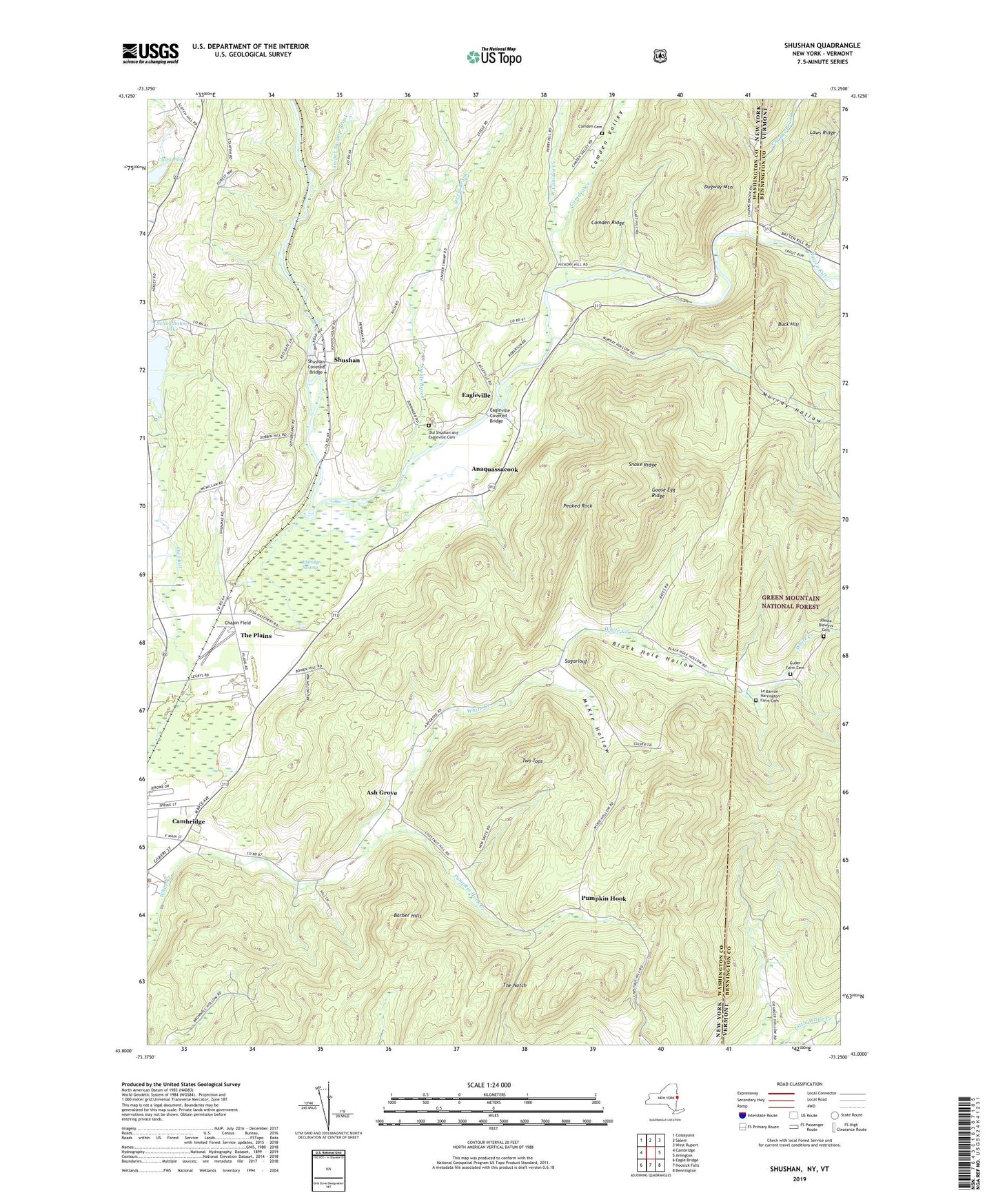
2023 topographic map quadrangle Shushan in the states of New York, Vermont. Scale: 1:24000. Based on the newly updated USGS 7.5' US Topo map series, this map is in the following counties: Washington, Bennington. The map contains contour data, water features, and other items you are used to seeing on USGS maps, but also has updated roads and other features. This is the next generation of topographic maps. Printed on high-quality waterproof paper with UV fade-resistant inks.
Quads adjacent to this one:
West: Cambridge
Northwest: Cossayuna
North: Salem
Northeast: West Rupert
East: Arlington
Southeast: Bennington
South: Hoosick Falls
Southwest: Eagle Bridge
Contains the following named places: Anaquassacook, Ash Grove, Barber Hills, Battenkill Riversports and Campground, Black Hole Hollow, Buck Hill, Cambridge Valley Rescue Squad, Camden Cemetery, Camden Creek, Camden Ridge, Camden Valley, Chapin Field, Chestnut Woods, Chunks Brook, Clark Pond, Dugway Mountain, Eagleville, Eagleville Covered Bridge, Eldridge Swamp, Flying Pigs Farm, Goose Egg Ridge, Guber Farm Cemetery, Hemlock Grove Farm, Juniper Swamp Brook, Lake Lauderdale, Lake Lauderdale Campground, Lake Lauderdale County Park, Laws Ridge, Le Barron - Harrington Farm Cemetery, McKie Hollow, Murray Hollow, Old Shushan and Eagleville Cemetery, Peaked Rock, Pumpkin Hook, Pumpkin Hook Creek, Ravenwood Estates, Rhoda Blowers Cemetery, School Number 11, School Number 6, School Number 7, School Number 9, Shushan, Shushan Covered Bridge, Snake Ridge, Steele Brook, Sugarloaf, The Notch, The Plains, Town of White Creek, Two Tops, West Camden Creek, Windy River Farm, ZIP Code: 12873