MyTopo
Fort Miller New York US Topo Map
Couldn't load pickup availability
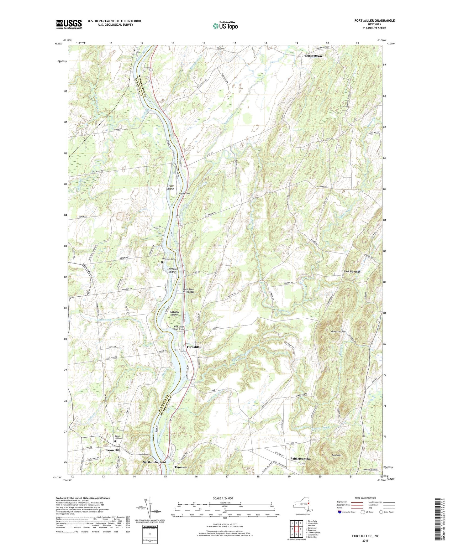
2023 topographic map quadrangle Fort Miller in the state of New York. Scale: 1:24000. Based on the newly updated USGS 7.5' US Topo map series, this map is in the following counties: Washington, Saratoga. The map contains contour data, water features, and other items you are used to seeing on USGS maps, but also has updated roads and other features. This is the next generation of topographic maps. Printed on high-quality waterproof paper with UV fade-resistant inks.
Quads adjacent to this one:
West: Gansevoort
Northwest: Glens Falls
North: Hudson Falls
Northeast: Hartford
East: Cossayuna
Southeast: Cambridge
South: Schuylerville
Southwest: Quaker Springs
This map covers the same area as the classic USGS quad with code o43073b5.
Contains the following named places: August Field, Bacon Hill, Bacon Hill Cemetery, Bald Mountain, Barber Brothers Dairy, Black House Creek, Black Orchid Stables, Clear Echo Farm, Dead Creek, Durkeetown, Durkeetown Baptist Church, Fort Miller, Fort Miller Road Bridge, Foster Farm, Galusha Island, Gavettes Brook, Gavettes Mountain, Griffin Island, Half-A-Chance Farm, Jewell Corner, Lick Springs, Lock Number 6, M And A Farm, Moses Creek Farm, Moses Kill, North Branch Snook Kill, North River Road Bridge, Northumberland, Papp Airpark, Pecks Creek, Pine Meadow Farm, Pleasant Valley Farm, Purintondale Farm, Slocum Creek, Snook Kill, Stonebridge Farm, Thomas Poultry Farm of Schuylerville, Thompson Cemetery, Thompson Island, Thomson, Town of Fort Edward, Tuttle Brook, Van Antwerp Creek, Welcome Stock Farm