MyTopo
Dresden New York US Topo Map
Couldn't load pickup availability
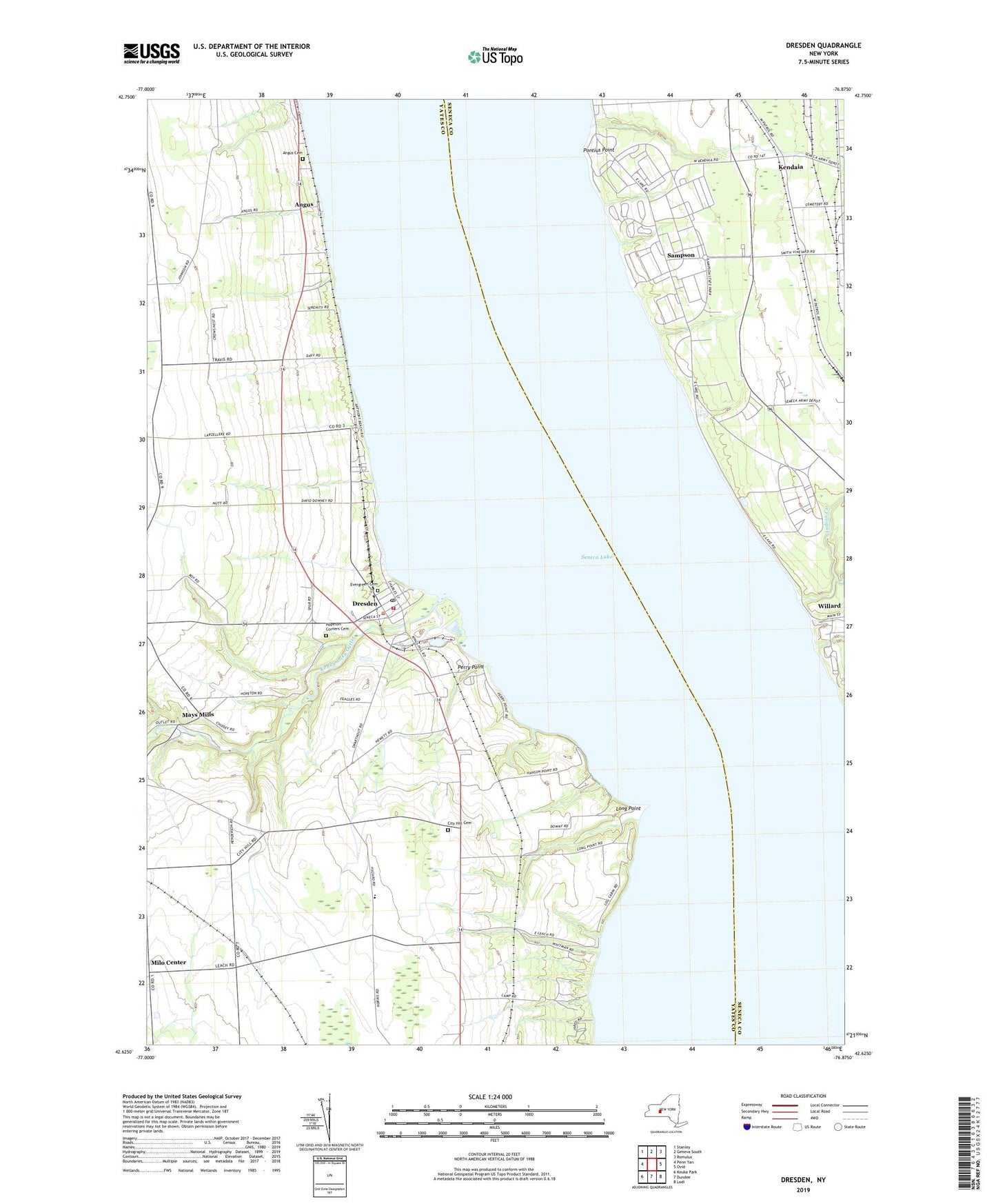
2019 topographic map quadrangle Dresden in the state of New York. Scale: 1:24000. Based on the newly updated USGS 7.5' US Topo map series, this map is in the following counties: Yates, Seneca. The map contains contour data, water features, and other items you are used to seeing on USGS maps, but also has updated roads and other features. This is the next generation of topographic maps. Printed on high-quality waterproof paper with UV fade-resistant inks.
Quads adjacent to this one:
West: Penn Yan
Northwest: Stanley
North: Geneva South
Northeast: Romulus
East: Ovid
Southeast: Lodi
South: Dundee
Southwest: Keuka Park
Contains the following named places: Angus, Angus Cemetery, Anthony Road Winery, Back Achers Campsites, Cascade Mills, City Hill Cemetery, Dresden, Dresden Fire Department, Dresden Post Office, Dresden United Methodist Church, Evergreen Cemetery, Fox Run Winery, Good Samaritan Baptist Church, Grace Gardens, Greenidge Power Plant, Hopeton Corners Cemetery, Indian Creek, Kendaia, Kendaia Kabins and Campground, Keuka Lake Outlet, Long Point, Mays Mills, Milo Center, Milo Station, Naval Training Station Sampson, New Conquest Mennonite School, Perry Point, Pontius Point, Prejean Winery, Ryal Corners, Sampson, Sampson State Park, School Number 1, School Number 2, School Number 3, School Number 4, Seneca Army Air Field, Simpson Creek, Torrey Ridge Winery, Town of Torrey, Townsend Corners, Village of Dresden, Willard State Hospital, ZIP Code: 14441