MyTopo
Keuka Park New York US Topo Map
Couldn't load pickup availability
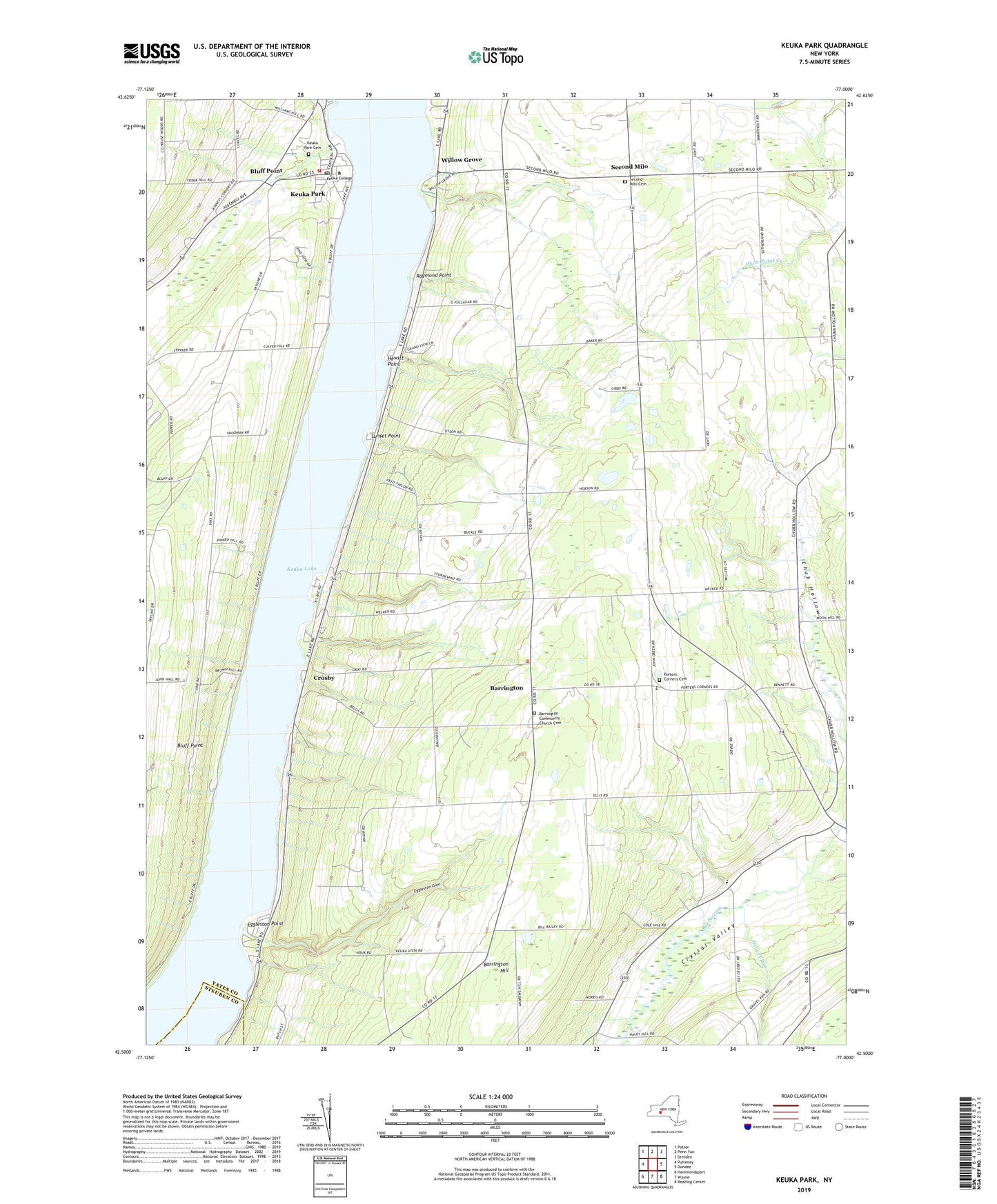
2023 topographic map quadrangle Keuka Park in the state of New York. Scale: 1:24000. Based on the newly updated USGS 7.5' US Topo map series, this map is in the following counties: Yates, Steuben. The map contains contour data, water features, and other items you are used to seeing on USGS maps, but also has updated roads and other features. This is the next generation of topographic maps. Printed on high-quality waterproof paper with UV fade-resistant inks.
Quads adjacent to this one:
West: Pulteney
Northwest: Potter
North: Penn Yan
Northeast: Dresden
East: Dundee
Southeast: Reading Center
South: Wayne
Southwest: Hammondsport
This map covers the same area as the classic USGS quad with code o42077e1.
Contains the following named places: A and L Farm, Barrington, Barrington Community Church, Barrington Community Church Cemetery, Bluff Point, Bluff Point United Methodist Church, Branchport - Keuka Park Fire Department - Keuka Park Fire Station, Buzzard Crest Vineyards, Chub Hollow, Creekside Mennonite School, Crosby, Eggleston Glen, Eggleston Point, Gravel Run, Gravel Run Mennonite School, Hewitt Point, Keuka College, Keuka Lake Church, Keuka Park, Keuka Park Cemetery, Keuka Park Census Designated Place, Keuka Park Post Office, Penn Yan Assembly of God, Porter Corner, Porters Corners Cemetery, Raymond Point, Scenic Valley Mennonite School, School Number 1, School Number 3, School Number 4, School Number 7, School Number 8, School Number 9, Second Milo, Second Milo Cemetery, Simmons Vineyard, Sunset Point, Thayer Corners, Town of Barrington, Town of Milo, Willow Grove