MyTopo
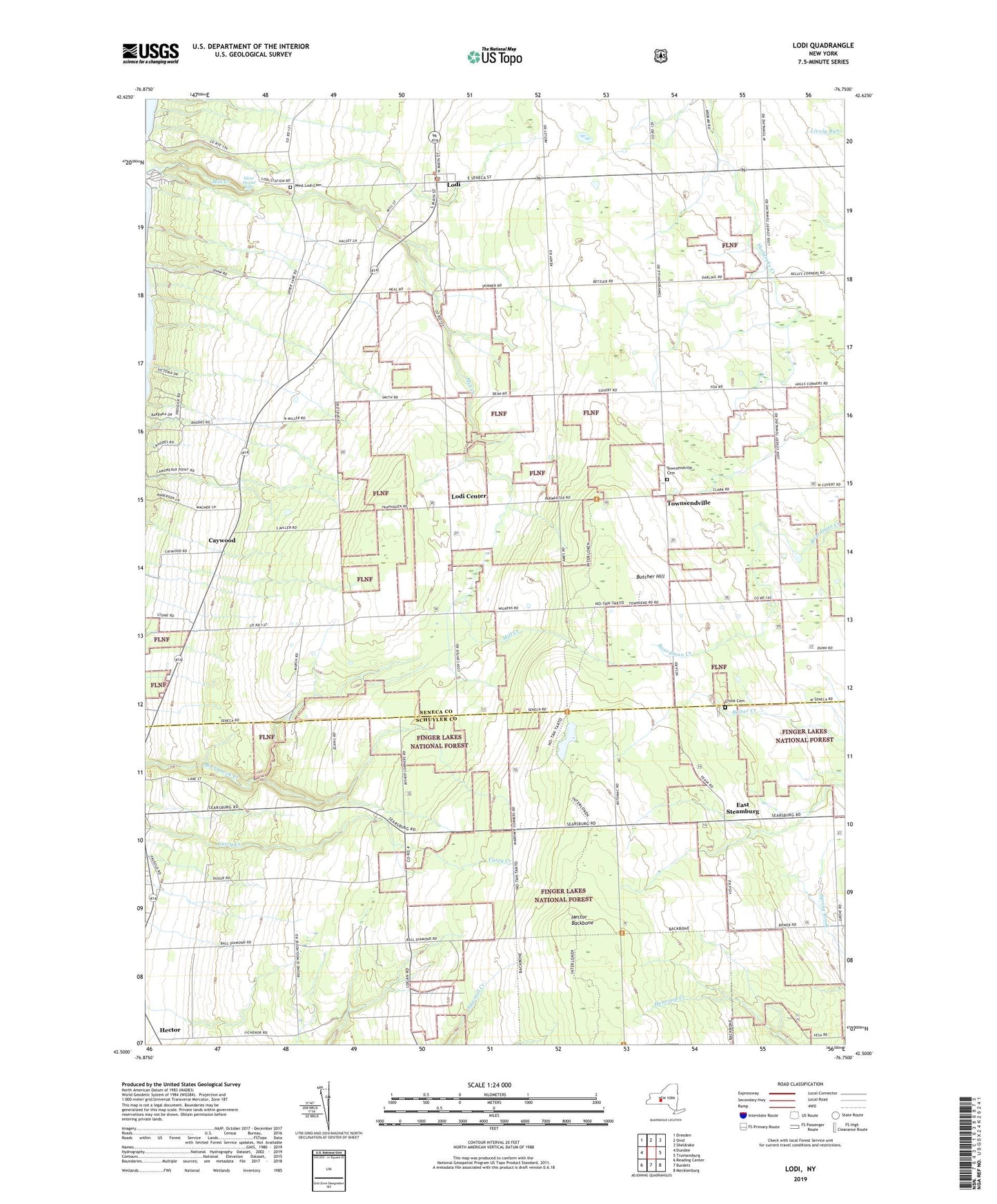
Lodi New York US Topo Map
Couldn't load pickup availability
Also explore the Lodi Forest Service Topo of this same quad for updated USFS data
2023 topographic map quadrangle Lodi in the state of New York. Scale: 1:24000. Based on the newly updated USGS 7.5' US Topo map series, this map is in the following counties: Seneca, Schuyler. The map contains contour data, water features, and other items you are used to seeing on USGS maps, but also has updated roads and other features. This is the next generation of topographic maps. Printed on high-quality waterproof paper with UV fade-resistant inks.
Quads adjacent to this one:
West: Dundee
Northwest: Dresden
North: Ovid
Northeast: Sheldrake
East: Trumansburg
Southeast: Mecklenburg
South: Burdett
Southwest: Reading Center
This map covers the same area as the classic USGS quad with code o42076e7.
Contains the following named places: Adventureland Farm, Alexander Farms, Bumpus Corners, Butcher Hill, Cat Elbow Corner, Caywood, Cronk Cemetery, Dalrymple Farms, East Steamburg, Finger Lakes National Forest, Gold Seal Vineyards, Green Mountain National Forest-Hector Ranger District, Hector, Hector Backbone, Hector Presbyterian Church, Interloken Trail, Kelly Corners, Lodi, Lodi Center, Lodi Landing, Lodi Post Office, Lodi Station, Lodi Whittier Library, Round School, School Number 1, School Number 19, School Number 3, School Number 4, School Number 7, Shalestone Vineyards, Silver Thread Falls, Spaulding Corner, Town of Lodi, Townsendville, Townsendville Cemetery, Venture Vineyards, Village of Lodi, Wagner Farms, Wagner Vineyards, West Lodi Cemetery, Westwind Farms, ZIP Codes: 14841, 14860