MyTopo
Edinburg New York US Topo Map
Couldn't load pickup availability
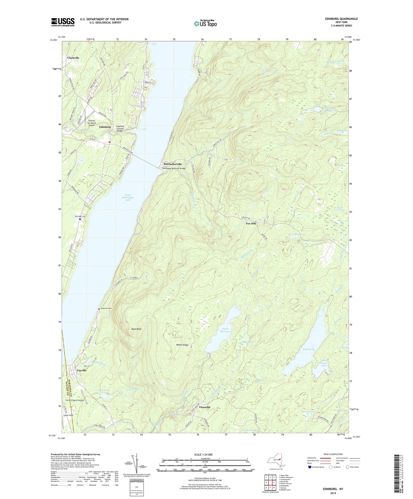
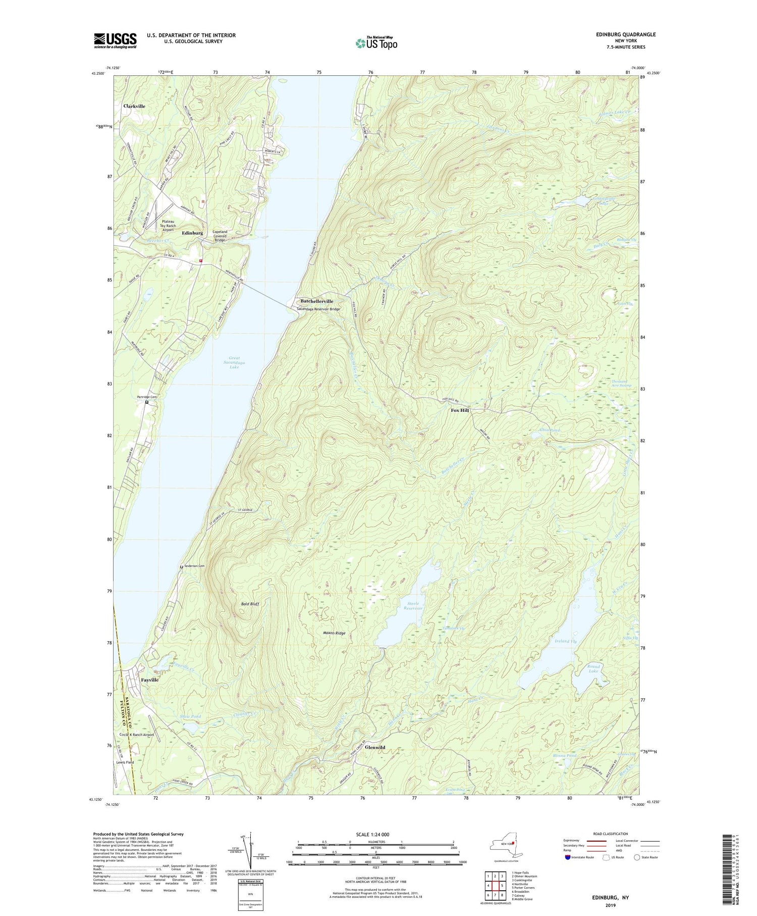
2019 topographic map quadrangle Edinburg in the state of New York. Scale: 1:24000. Based on the newly updated USGS 7.5' US Topo map series, this map is in the following counties: Saratoga, Fulton. The map contains contour data, water features, and other items you are used to seeing on USGS maps, but also has updated roads and other features. This is the next generation of topographic maps. Printed on high-quality waterproof paper with UV fade-resistant inks.
Quads adjacent to this one:
West: Northville
Northwest: Hope Falls
North: Ohmer Mountain
Northeast: Conklingville
East: Porter Corners
Southeast: Middle Grove
South: Galway
Southwest: Broadalbin
Contains the following named places: Adirondack Bible College, Albia Pond, Anderson Cemetery, Bald Bluff, Batcheller Creek, Batchellerville, Batchellerville Presbyterian Church, Beecher Creek, Blodgett Vly, Circle K Ranch Airport, Clarkville, Cloutler Creek, Consolidated School Number 1, Cooks Reservoir, Copeland Covered Bridge, Deming Creek, Edinburg, Edinburg Bible Chapel, Edinburg Emergency Squad, Edinburg Town Hall, Edinburg United Methodist Church, Edinburg Volunteer Emergency Squad, Edinburg Volunteer Fire Company, Fayville, Fayville Creek, Fox Hill, Glenwild, Gordons Creek, Ireland Vly, Johnnycake Lake, Lewis Field, Little Hans Creek, Loon Vly, Maxon Ridge, Partridge Cemetery, Plateau Sky Ranch Airport, Ronna Pond, Round Lake, Sacandaga Reservoir Bridge, School Number 1, Shew Pond, Steele Creek, Steele Reservoir, Tamarack Vly, The Farm Airport, Thousand Acre Swamp, Town of Edinburg, West Vly Creek