MyTopo
Gallupville New York US Topo Map
Couldn't load pickup availability
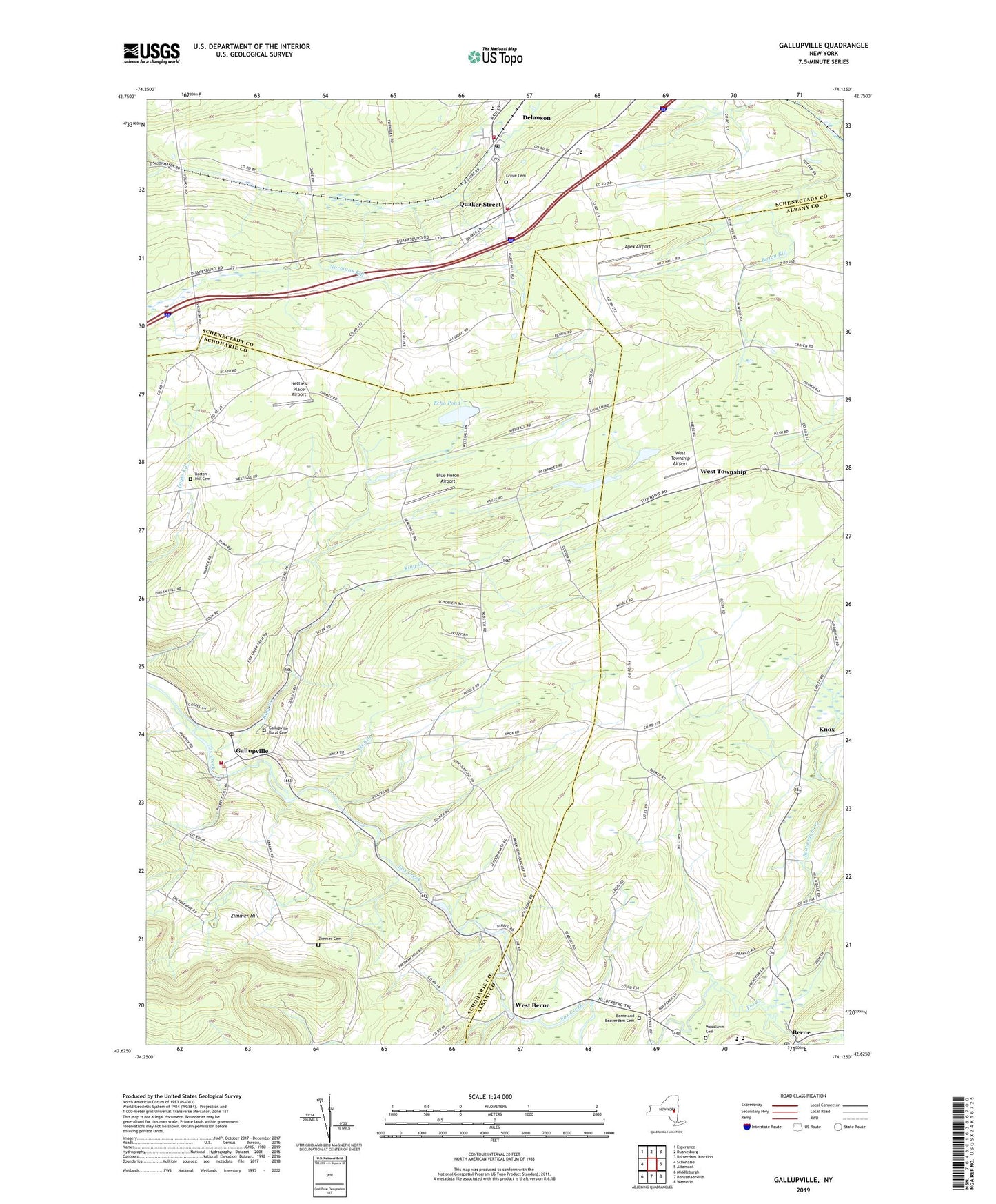
2023 topographic map quadrangle Gallupville in the state of New York. Scale: 1:24000. Based on the newly updated USGS 7.5' US Topo map series, this map is in the following counties: Schoharie, Albany, Schenectady. The map contains contour data, water features, and other items you are used to seeing on USGS maps, but also has updated roads and other features. This is the next generation of topographic maps. Printed on high-quality waterproof paper with UV fade-resistant inks.
Quads adjacent to this one:
West: Schoharie
Northwest: Esperance
North: Duanesburg
Northeast: Rotterdam Junction
East: Altamont
Southeast: Westerlo
South: Rensselaerville
Southwest: Middleburgh
This map covers the same area as the classic USGS quad with code o42074f2.
Contains the following named places: Apex Airport, Barton Hill Cemetery, Beaverdam Creek, Berne, Berne - Knox - Westerlo Elementary School, Berne - Knox - Westerlo Secondary School, Berne and Beaverdam Cemetery, Berne Post Office, Blue Heron Airport, Delanson, Delanson Post Office, Delanson United Methodist Church, Delanson Volunteer Fire Department, Duanesburg Elementary School, Duanesburg Middle School-High School, Echo Pond, Elk Hill Winery, Gallupville, Gallupville Post Office, Gallupville Rural Cemetery, Gallupville Volunteer Fire Department, Grove Cemetery, King Creek, Lee Church, Nettie's Place Airport, Ox Kill, Quaker Street, Quaker Street Bible Church, Quaker Street Fire District 1, Saint Peters Chapel, Schenectady County Public Library Quaker Street Branch, School Number 1, School Number 11, School Number 15, School Number 19, School Number 2, School Number 3, School Number 5, Town of Wright, Village of Delanson, Wandervogel Gliderport, West Berne, West Township, West Township Airport, Woodlawn Cemetery, Zimmer Cemetery, Zimmer Hill