MyTopo
Grahamsville New York US Topo Map
Couldn't load pickup availability
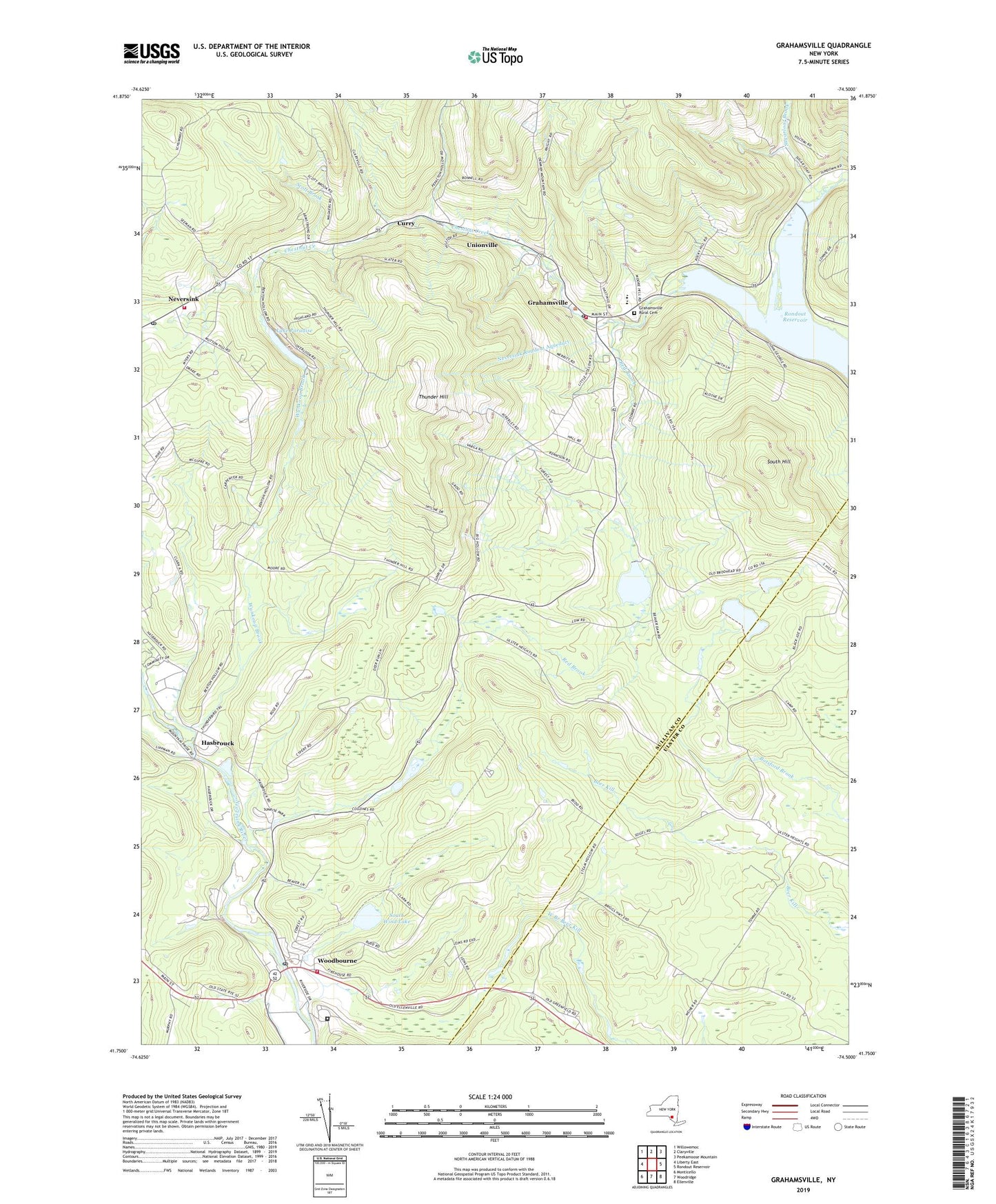
2023 topographic map quadrangle Grahamsville in the state of New York. Scale: 1:24000. Based on the newly updated USGS 7.5' US Topo map series, this map is in the following counties: Sullivan, Ulster. The map contains contour data, water features, and other items you are used to seeing on USGS maps, but also has updated roads and other features. This is the next generation of topographic maps. Printed on high-quality waterproof paper with UV fade-resistant inks.
Quads adjacent to this one:
West: Liberty East
Northwest: Willowemoc
North: Claryville
Northeast: Peekamoose Mountain
East: Rondout Reservoir
Southeast: Ellenville
South: Woodridge
Southwest: Monticello
This map covers the same area as the classic USGS quad with code o41074g5.
Contains the following named places: Allison Farms, Beaverdam Pond, Central School, Chestnut Creek, Curry, Daniel Pierce Library, Grahamsville, Grahamsville Census Designated Place, Grahamsville First Aid Squad, Grahamsville Post Office, Grahamsville Rural Cemetery, Grahamsville Volunteer Fire Department, Grahamsville Wastewater Treatment Plant, Hasbrouck, Lake Paradise, Laughing Duck Farm, Lowes Corners, Neversink, Neversink Post Office, Neversink Rondout Aqueduct, Neversink Town Hall, Neversink Volunteer Fire Department Station 1 and Ambulance, Red Brook, Scott Brook, South Hill, South Wind Lake, Sugarloaf Brook, Sunrise Mobile Home Park, Thunder Hill, Town of Neversink, Tri - Valley Elementary School, Tri - Valley High School, Tri - Valley Middle School, Unionville, Woodbourne, Woodbourne Census Designated Place, Woodbourne Correctional Facility, Woodbourne Fire Company Number 1, Woodbourne Post Office, Wynkoop Brook, ZIP Codes: 12765, 12788