MyTopo
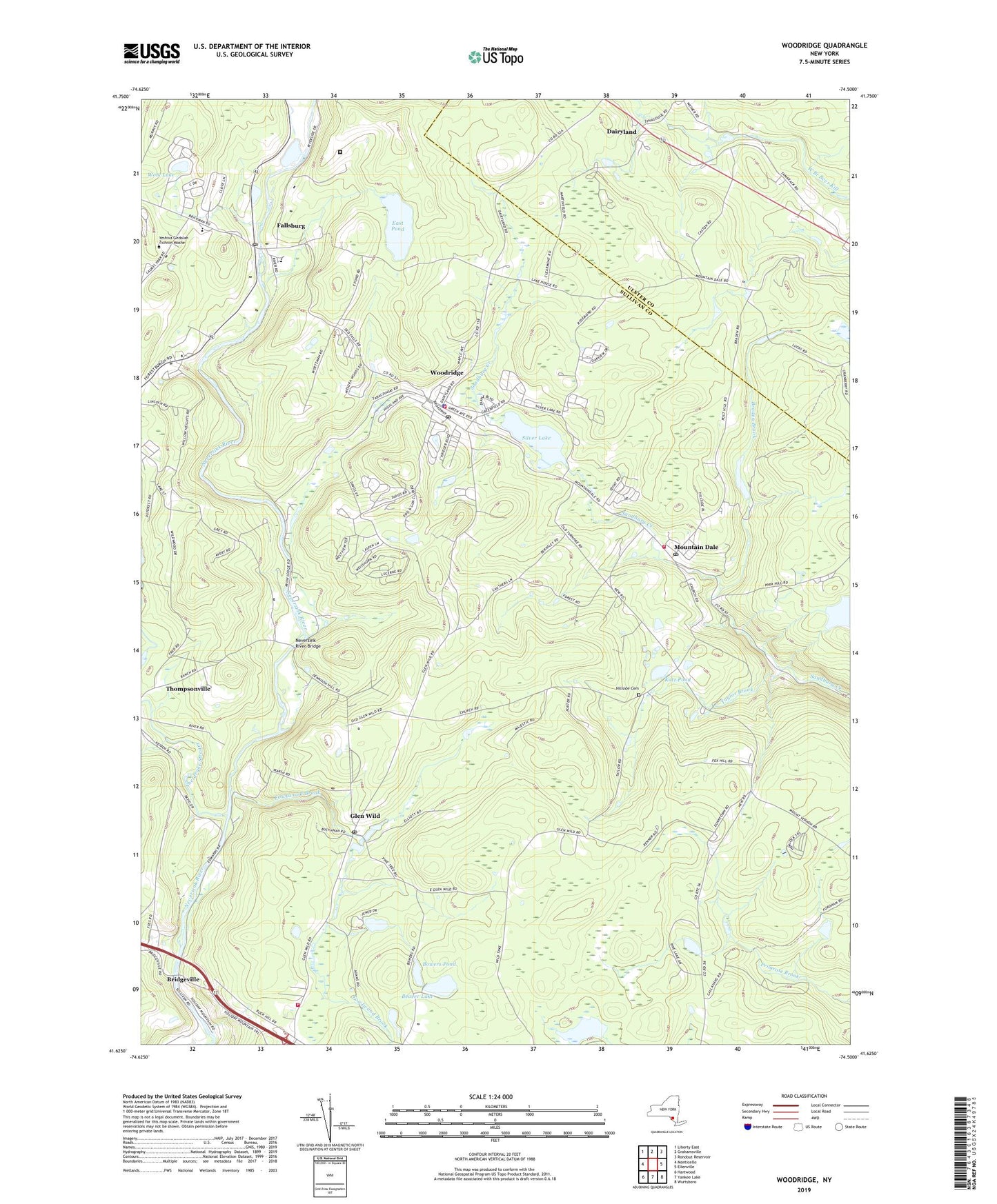
Woodridge New York US Topo Map
Couldn't load pickup availability
2023 topographic map quadrangle Woodridge in the state of New York. Scale: 1:24000. Based on the newly updated USGS 7.5' US Topo map series, this map is in the following counties: Sullivan, Ulster. The map contains contour data, water features, and other items you are used to seeing on USGS maps, but also has updated roads and other features. This is the next generation of topographic maps. Printed on high-quality waterproof paper with UV fade-resistant inks.
Quads adjacent to this one:
West: Monticello
Northwest: Liberty East
North: Grahamsville
Northeast: Rondout Reservoir
East: Ellenville
Southeast: Wurtsboro
South: Yankee Lake
Southwest: Hartwood
This map covers the same area as the classic USGS quad with code o41074f5.
Contains the following named places: Beaver Lake, Benjamin Cosor Elementary School, Bowers Pond, Braden Brook, Bridgeville, Dairyland, East Pond, Fallsburg, Fallsburg Census Designated Place, Fallsburg Junior - Senior High School, Fallsburg Post Office, Fowlwood Brook, Glen Wild, Glen Wild Post Office, Hillside Cemetery, Katz Pond, Little Grove Holiness Church, Mountain Dale, Mountain Dale Census Designated Place, Mountain Dale Post Office, Mountaindale Fire District, Mountaindale Wastewater Treatment Plant, Neversink River Bridge, Rock Hill, Rock Hill Drive-In, Rock Hill Fire Department, Saint Andrew Episcopal Church, Sheldrake Stream, Silver Lake, South Fallsburg Wastewater Treatment Plant, Sullivan Correctional Facility, Sullivan Correctional Facility Heliport, Taylor Brook, The First Church of God, Town of Fallsburg, Village of Woodridge, Wohl Lake, Woodridge, Woodridge Post Office, Woodridge Village Wastewater Treatment Plant, Woodridge Volunteer Fire Department, ZIP Codes: 12435, 12733, 12738, 12763, 12789