MyTopo
Grampus Lake New York US Topo Map
Couldn't load pickup availability
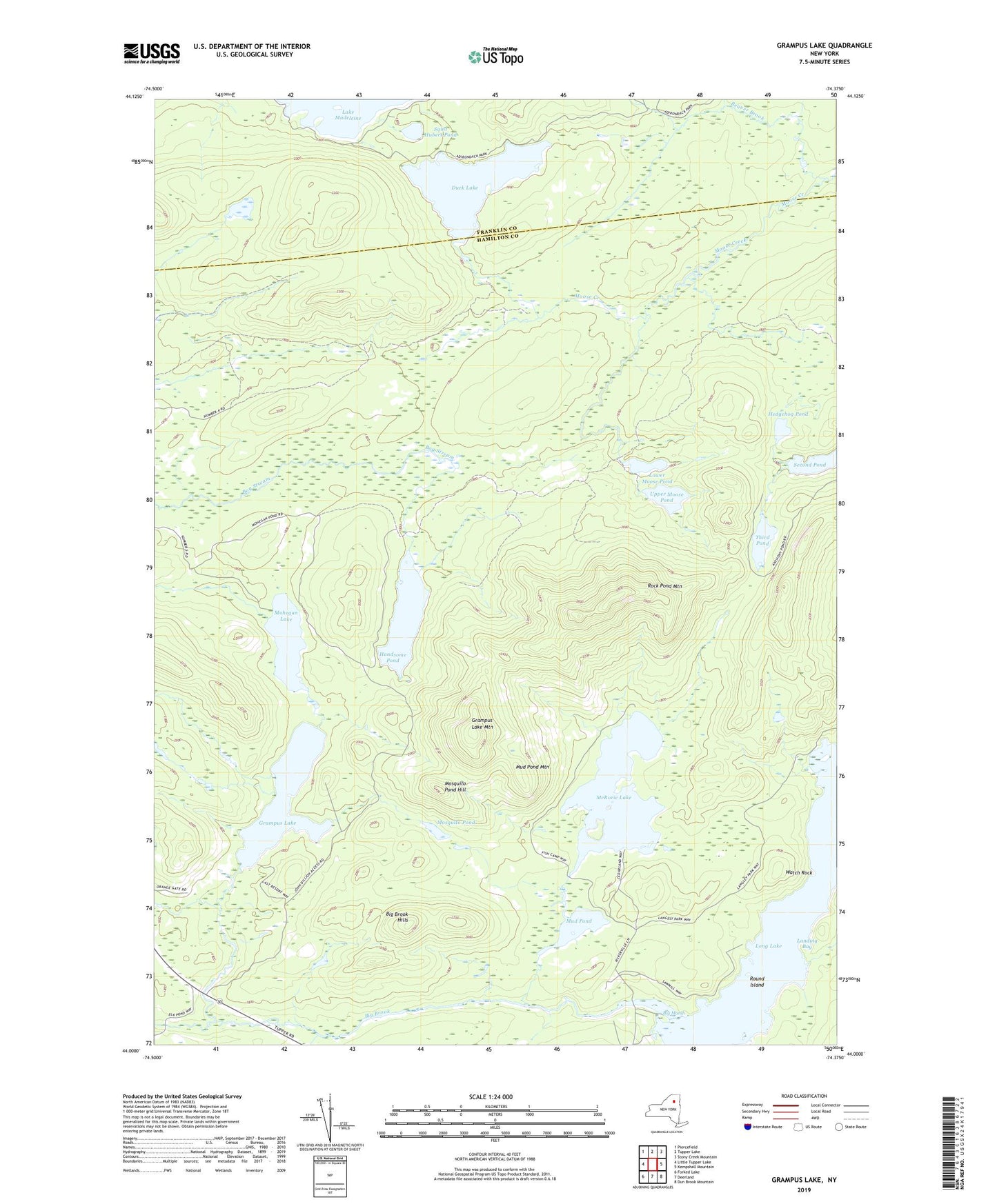
2019 topographic map quadrangle Grampus Lake in the state of New York. Scale: 1:24000. Based on the newly updated USGS 7.5' US Topo map series, this map is in the following counties: Hamilton, Franklin. The map contains contour data, water features, and other items you are used to seeing on USGS maps, but also has updated roads and other features. This is the next generation of topographic maps. Printed on high-quality waterproof paper with UV fade-resistant inks.
Quads adjacent to this one:
West: Little Tupper Lake
Northwest: Piercefield
North: Tupper Lake
Northeast: Stony Creek Mountain
East: Kempshall Mountain
Southeast: Dun Brook Mountain
South: Deerland
Southwest: Forked Lake
Contains the following named places: Adirondack Mountains, Anthony Ponds, Beaver Brook, Big Brook, Big Brook Hills, Big Marsh, Duck Lake, Grampus Lake, Grampus Lake Mountain, Handsome Pond, Hedgehog Pond, Landing Bay, Lower Moose Pond, McRorie Lake, Mohegan Lake, Mosquito Pond, Mosquito Pond Hill, Mud Pond, Mud Pond Mountain, Rock Pond Mountain, Round Island, Saint Hubert Pond, Second Pond, Third Pond, Upper Moose Pond, Watch Rock