MyTopo
Little Tupper Lake New York US Topo Map
Couldn't load pickup availability
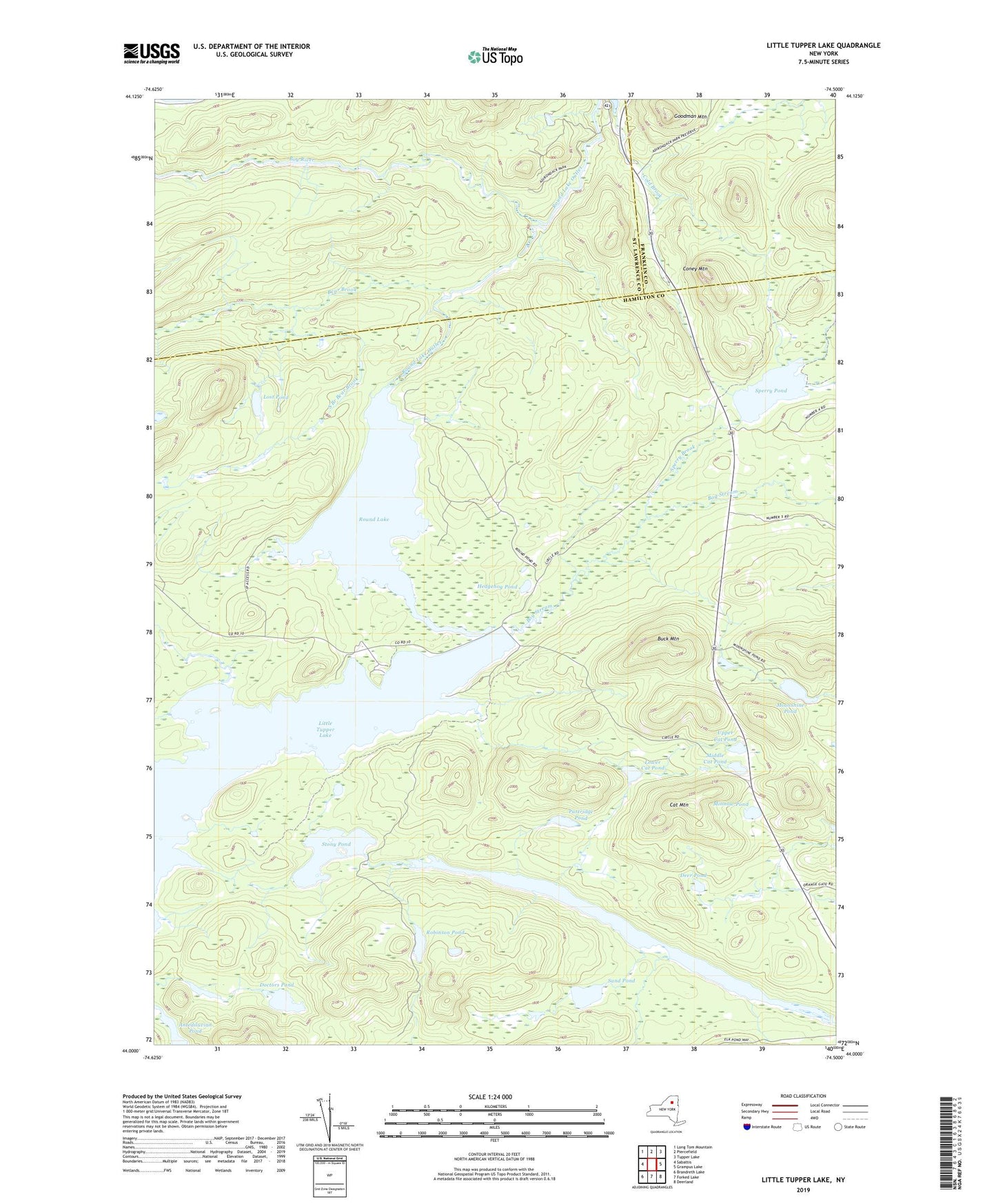
2023 topographic map quadrangle Little Tupper Lake in the state of New York. Scale: 1:24000. Based on the newly updated USGS 7.5' US Topo map series, this map is in the following counties: Hamilton, St. Lawrence, Franklin. The map contains contour data, water features, and other items you are used to seeing on USGS maps, but also has updated roads and other features. This is the next generation of topographic maps. Printed on high-quality waterproof paper with UV fade-resistant inks.
Quads adjacent to this one:
West: Sabattis
Northwest: Long Tom Mountain
North: Piercefield
Northeast: Tupper Lake
East: Grampus Lake
Southeast: Deerland
South: Forked Lake
Southwest: Brandreth Lake
This map covers the same area as the classic USGS quad with code k44074a5.
Contains the following named places: Antediluvian Pond, Bear Brook, Bog Stream, Buck Mountain, Cat Mountain, Cold Brook, Coney Mountain, Deer Pond, Doctors Pond, Goodman Mountain, Hedgehog Pond, Little Tupper Lake, Lost Pond, Lower Cat Pond, Middle Cat Pond, Minnow Pond, Moonshine Pond, Partridge Pond, Robinson Pond, Round Lake, Round Lake Outlet, Sand Pond, Slim Pond, South Branch Bear Brook, Sperry Brook, Sperry Pond, Stony Pond, Upper Cat Pond, Whitney Headquarters, ZIP Code: 12847